Showing posts with label British. Show all posts

Tuesday, 24 May 2022

How tall will Mount Everest get before it stops growing?

 Arching over 8,849 metres (29,032ft) into the sky, Everest is the world’s tallest mountain. But will it always be?

Aurora Elmore was approaching Mount Everest's South Base Camp in Nepal. But rather than taking the traditional 12-day hiking route, she was soaring between the frozen peaks, the rotor blades of her helicopter slicing through the thin air with a whap, whap, whap.


It was April 2019, and she was delivering supplies to a team of scientists working on the slopes of the world's tallest mountain. Her reward was a spectacular view: the day was crystal clear, exposing the entire Himalayan range.


Over the next two months, researchers on the National Geographic and Rolex expedition she helped to organise would study the effects of climate change on this part of the Himalayas. Elmore, a geologist and at the time senior programme manager of the National Geographic Society in the US, supported the team installing the world's highest weather station on the flanks of Mount Everest. During the course of their expedition, her colleagues discovered the world's highest evidence of microplastic pollution in snow and stream water close to the summit. 


Gliding closer to Everest's iconic peak, Elmore got a bird's-eye view of them. A miniature city of green and yellow tents, each sheltering mountaineers headed for the top, had formed at Everest Base Camp more than 5km (3 miles) above sea level. Thousands flock to Everest every spring to make an attempt to reach the roof of the world.


And while few of the climbers would have noticed, Everest grew a tiny bit bigger during their time on the mountain.

Mount Everest, along with the rest of the Himilayas, inches further skyward every year. It raises an interesting question – with enough time, just how tall can Mount Everest grow? There are mountains on other planets in our Solar System that dwarf those on our own, so are there limits to how big a mountain can get on Earth?


Mount Everest towers 8,848.86m (29,032ft) above sea level, according to the most recent official joint survey by China and Nepal, whose borders run across its summit. But it isn't the only giant in these lands – 10 of the world's 14 peaks higher than 8,000m (26,247ft) above sea level can be found in the Himalayan range. Everest, Elmore says, is among friends. "If you've ever flown over Greenland or the Canadian Rockies you can see big mountains, but [the Himalayas] are just on another level," she says.


Surrounded by so many other enormous peaks, is it possible to discern just what a monster Everest is? Elmore hesitates before answering. "It's kind of like trying to tell the tallest person on a basketball team," she says finally. "They're all tall, but which one is the teeny [bit taller]?"


The history of measuring the tallest mountain in the world stretches back to 1852. In Europe, Charles Dickens was publishing serialised instalments of his novel Bleak House. North America had started testing its first steam-powered fire engine. In Asia, the height of Mount Everest was a mystery. It was known only as "Peak XV". Radhanath Sikdar, an Indian mathematician, had been employed by the British to work on their Great Trigonometrical Survey. They wanted to gather a more accurate geographical picture of the territory they were occupying so they could control it more effectively, be it for trade or military purposes.


Sikdar used trigonometry. He measured the horizontal and vertical angles of Everest's summit from other mountaintops whose positions and heights were already known. In doing so he made a momentous discovery: the tallest mountain ever recorded. According to his calculations, the mountain stood at 8,839.8m (29,002ft) tall.


Though the technology behind measuring mountains has advanced since the 1850s, his figure was astonishingly accurate, just nine metres off the latest official height. Despite Sikdar's findings, the mountain eventually was named after his previous boss, British surveyor Sir George Everest, who had retired several years before Sikdar's discovery.


At more than 8,848m (29,032ft) tall, Mount Everest towers over the other giants in the Himalayas (Credit: Getty Images)


Since then, teams have continued to work to understand Mount Everest's height. In 1954 an Indian survey determined Mount Everest to be 8,848m (29,029ft) tall, a figure which was accepted by the Nepalese government. But then, in 2005, the Chinese measured it at 8,844.43m (29,017ft) – nearly four metres (13ft) lower. In 2020, teams from China and Nepal jointly agreed upon a new officially accepted height that was 0.86m (2.8ft) higher than the Survey of India's original calculation. 


While these changes in the measured height are partly due to improvements in the measuring technology available to surveyors, there has also been some politics involved. China and Nepal historically have argued over whether the snow cap on the summit should be included in the measurement or not.


But we mustn't ignore that Everest also grows a tiny little bit taller every year too.


Once, the craggy limestone peaks that skim the sky of Everest were on the ocean floor. Scientists believe it all began to change about 200 million years ago – at around the time the Jurassic dinosaurs were beginning to emerge – when the supercontinent of Pangea cracked into pieces. The Indian continent eventually broke free, journeying north across the vast swathe of Tethys Ocean for 150 million years until it smacked into a fellow continent – the one we now know as Asia – around 45 million years ago.


The crushing force of one continent hitting another caused the plate beneath the Tethys Ocean, made of oceanic crust, to slide under the Eurasian plate. This created what is known as a subduction zone. Then the oceanic plate slipped deeper and deeper into the Earth’s mantle, scraping off folds limestone as it did so, until the Indian and Eurasian plates started compressing together. India began sliding under Asia, but because it's made of tougher stuff than the oceanic plate it didn't just descend. The surface started to buckle, pushing the crust and crumples of limestone upwards.


Weather stations installed on Mount Everest were damaged by rocks the size of cricket balls that were picked up by the wind


And so the Himalayan mountain range began to rise skyward. By around 15-17 million years ago, the summit of Everest had reached about 5,000m (16,404ft) and it continued to grow. The collision between the two continental plates is still happening today. India continues to creep north by 5cm (2in) a year, causing Everest to grow by about 4mm (0.16in) per year (although other parts of the Himalayas are rising at around 10mm per year [0.4in]).

But understanding how and why Everest's height changes is more complex than just this. While plate tectonics push the summit higher into the sky, erosion claws away at it.


To understand this process better, scientists studied another mountain some 8,700km (5,405 miles) away from Mount Everest, in Alaska.


Rachel Headley, an associate professor of geosciences at the University of Wisconsin-Parkside, was part of a scientific expedition to Mount Saint Elias on the border of Alaska and Canada between 2005-2008. The mission intended to understand the complex roles of tectonics and erosion in how mountains grow and shrink. The second largest mountain in both Canada and the US, Saint Elias faces the same effects as Everest, from tectonic activity to erosion, but across a far smaller, more manageable area. "In that region, Alaska, there were very particular weather patterns that had helped these large glaciers grow," Headley says. "And then both glaciers and rivers, landslides, and avalanches were all kind of the processes that connected to tear them down."


Headley's role on the team was to understand the thickness of the Seward Glacier, which runs through the Saint Elias mountains, and how fast it was moving. Both can impact the rate of erosion, which can affect how quickly a mountain's height is worn away. "If we have a thinner glacier, and it's moving super fast… we know there has to be some sliding, which we think is really important for erosion," she says. "Sliding" can cause glacial abrasion, which is when the glacier drags rock fragments across the surface as it moves, creating a sandpapering effect.


Weather can also cause significant erosion to a mountain. Elmore describes one of the weather stations she helped install during the 2019 Mount Everest expedition as being "damaged by rocks the size of cricket balls that were picked up by the wind and thrown at it". Buffetting by debris and ice picked up by the wind takes its toll after a while.
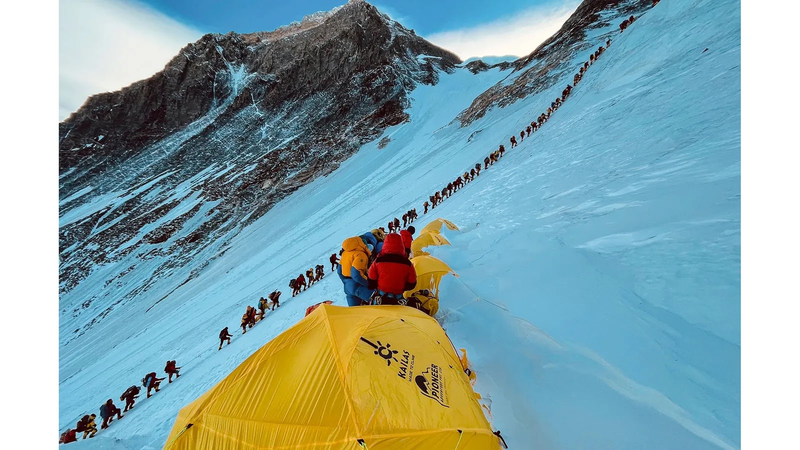

The main routes up Mount Everest have now become so popular with climbers that long queues can form (Credit: Lakpa Sherpa/AFP/Getty Images)


Many of the highest peaks in the world, including Everest, have permanent snow caps that help protect them from this wind-blown barrage. Rock covered in a soft blanket of snow suffers less weathering and erosion than bare rock, says Headley. It also protects the rock from chemical reactions with the air that can gradually degade the minerals in the limestone that comprises much of the uppermost parts of Mount Everest. But there are still places where the rock is exposed to the elements.


"For a tall mountain range, you can basically get to such a steep angle in the rock that it can't actually support ice, and snow, and then you start to get avalanches, and you get bare rock," says Elmore. Rock falls and land slides – a constant hazard on Everest and the surrounding area – both play a role in shaving away at Everest's height, and rivers too. They have been estimated to be cutting gorges into the rock at a rate of between 4-8mm (0.2-0.3in) a year.


But the exact impact erosion has on a mountain's height is still to be understood. Some scientists believe that reducing the weight of a mountain (by taking away the snow, ice and rock it's made of) might actually allow the tectonic plates to push the, now lighter, mountain even further into the sky. 


Headley's colleague Terry Pavlis, who was the lead investigator on the St Elias Erosion Tectonics Project (Steep), explains that, on a large scale, "erosion attacking a landscape allows it to rise up".


In some parts of the world, entire landmasses are still rearing up after the last ice age – something known as isostatic rebound. Parts of North America and northern Europe, including Scotland, are rebounding after the rocky crust there was squashed by enormous continental ice sheets that waxed and waned during the Pleistocene. According to one study by researchers at Germany's University of Postdam, up to 90% of the uplift in the European Alps can be explained by this surprisingly elastic response to the end of the ice age. Experts believe similar glacial isostatic rebound may have taken place on the Tibetan Plateau and in the Himalaya as the ice age glaciers receeded – contributing between 1-4mm (0.04-0.16in) a year to the uplift.


"But there's some kind of equilibrium between how fast that landscape can erode and how high those peaks can get," adds Pavlis.


The exact details of this equilibrium are still being explored. In a region like the Appalachians in north-eastern North America, or the Scottish Highlands, erosive forces like rivers and landslides are cutting mountains down lower and lower, Headley says. "But in regions with tectonic activity, the tectonic force can be driving the mountains up slower, faster, or at around the same rate as the erosion is cutting it down. We don't fully understand all the drivers in those types of systems."
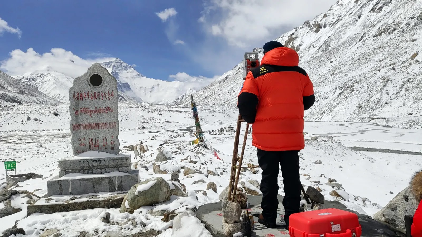

The most recent official height for Mount Everest was agreed following Chinese and Nepalese surveying expeditions to the summit (Credit: VCG/Getty Images)


So how are mountains actually measured nowadays? One of the most common instruments used is the Global Navigation Satellite System (GNSS), which records the precise position of the mountain peak using a network of satellites. GNSS can "measure heights to the millimetre," according to Pavlis. The challenge, for a mountain like Everest, has always been the weight of the equipment. "It's hard enough to get to the peak – try adding a 30lb (13kg) instrument," he says.


A helicopter taxi to the top with the heavy luggage is out of the question – the thin air around Everest's summit means the engine can't produce enough power and there's too much drag from the rotor blades to operate safely. The strong winds and jagged creeks also make touching down anywhere near the summit dangerous. One helicopter pilot did set a world record by touching down briefly on top of Mount Everest in 2005, but only after the manufacturer stripped it bare of every unessential item to make it feather light.


Luckily, GNSS systems have gotten smaller over the years. Now they weigh more like 1.2kg (2.6lbs) and are "about the size of a lunchbox, maybe a little smaller", says Pavlis. But the devices still need batteries, which can struggle in cold temperatures. The average temperature at the summit of Everest during the summer monsoon months is a balmy -19C. And there are other complications too. "There's an antenna that's about, you know, half a metre in diameter. And those have to be set up somehow so that they are absolutely stationary," Pavlis explains. 


To gather millimetre-accurate results the instrument then has to record for several hours. In the thin air of Everest's "death zone", operating these instruments can be hazardous for surveyors. Members of a Nepalese expedition to take GNSS measurements on Everest in 2019 spent two hours on the summit – far longer than most who make their way there – after arriving at 03:00 in the pitch black and biting cold.


Another option, often used in addition to GNSS for the most accurate readings, is Ground Penetrating Radar (GPR). "GPR uses radar pulses to image below the surface, so it can tell us the thickness and internal structure of snow and ice overlying the rocks on Everest's summit," says Elmore. "There's something like 4m (13ft) of snow and ice on the top of Mount Everest, but that can change depending on the climate."


The mountain that measures the greatest distance from the centre of Earth to its peak is Chimborazo in Equador, at 10,920m (35,826ft)


While Elmore and her team were conducting their own scientific experiments on Everest they leant the Nepalese expedition a GPR device so they could take measurements from the summit. "It had to be a specific design of GPR, one that was super lightweight so [it could be carried] to the top of Everest, but that also had the right transmitter and receiver to measure the ice," says Elmore. The device had recently been used at the summit of Denali, the tallest mountain in the US, so they knew it was up to the job.


Despite the many hurdles they faced, the Nepalese team's expedition to measure the height of Everest was successful. They had hoped to answer questions about whether a deadly 7.8 magnitude earthquake that hit Nepal in April 2015 had affected Mount Everest's height. Initial reports indicated the mountain had shifted 3cm (1.9in) to the south-west by the large earthquake, which killed 9,000 people and damaged hundreds of thousands of homes, but had not changed its height.


The project, however, soon became muddied with international politics. A few months later a team of Chinese surveyors conducted their own measurements during an expedition from the other side of the mountain. They had their own figure, which didn't include the snow cap. The Nepalese figure, on the other hand, did. In October 2019, the two countries decided to combine their data and in December 2020 they released the figure for the new official height – 8,848.86m (29,032ft), including the snow on top.


As China and Nepal found, deciding exactly what you measure, and how you measure, is fundamental to establishing a mountain's height. For example, to agree upon how tall a mountain is, we must first agree on where the bottom is. But that's not as easy as it might sound.


For centuries mountains have been measured using sea level as the base from where their height is calculated. But the Earth is not perfectly round: it bulges along the equator. And sea level isn't static, it is pulled and changed by our planet's gravity. Plus, Everest isn't sticking out of the ocean, it's nestled among a landscape of other mountains. 


Many complex calculations have to be done to establish where sea level would actually be, and Everest's relative height to it. When that starting point is changed, everything changes.


The Himalayas began rising around 45 million years ago as the Indian and Eurasian continental plates collided (Credit: Rik Olde Engberink/Alamy)


But let's say scientists started their measurements from the core of the planet instead. Everest would no longer be considered the tallest mountain on Earth. The mountain that measures the greatest distance from the centre of Earth to its peak is Mount Chimborazo, in Equador at 10,920m (35,826ft). What about starting from the seabed? The accolade of tallest mountain would then go to Mauna Kea, a volcano in Hawaii that arches 10,000m (32,808ft) from the ocean floor.


Looking beyond our own planet, we can see examples of just how enormous mountains can become. Olympus Mons, a volcano on Mars, towers 21km (19.2 miles) into the sky and stretches 624km (388 miles) wide. It is roughly the size of the state of Arizona. Because gravity on Mars is weaker than on Earth, and because Mars doesn't have tectonic plates shifting and colliding beneath the surface, the ooze of lava that flowed out of the Martian volcano in the planet's past was able to grow to monstrous proportions.


Could Everest become a similar giant? In the 1980s, a researcher at the Cavendish Laboratory in Cambridge, UK, attempted to estimate what such a limit might be on Earth, taking into account the strength of gravity and the strength of the rock underlying the mountain. The calculations, which made "no presensions to serious geophysics" estimated the theoretical maximum height of a mountain range with a granite base – as Mount Everest largely has – to be 45km (28 miles) on Earth. 


But there are a number of barriers – apart from our planet's relentless weather – that might stand in the way of this, according to Headley. For starters, "you would eventually run out of your tectonic forces, and then it would stop growing", she says. Scientists believe that eventually the Earth's mantle will cool to such a degree that the planet-wide dance of plate tectonics will end. Until then, earthquakes and landslides will also erode away the mountain too.


"At some point, [the mountain] becomes so steep that it's unstable and chunks start falling off," Elmore says.

With the wind, snow and ice buffeting, cracking and splitting the rock, Everest is unlikely to ever reach the sizes seen on Mars. "We have our weather systems, and weather is really good at creating erosional forces," Headley says. "Basically, the fact that we have water, whether in the form of ice or snow, or just rain, is what really can limit mountain growth."


For now, Everest keeps edging, bit by bit, into the sky as other forces try to tear it down. Elmore's 2019 team discovered global warming was yet another of these, driving considerable thinning of the snow and ice on the upper reaches of the mountain in recent decades and revealing more bare rock to the erosive impacts of weather.


Olympus Mons, a volcano on Mars, towers 21km (19.2 miles) into the sky and stretches 624km (388 miles) wide


Everest is also far from being the fastest-growing mountain on our planet. The closest contender for the top spot is perhaps Nanga Parbat, a neighbour to Everest located in the Pakistani Himalayan range, which is 8,126m (26,660ft) tall and growing at 7mm (0.27in) per year. In 241,000 years it could overtake Everest to be the tallest mountain on Earth, provided rates of erosion don't change.


Others, such as those in the Swiss Alps, are also growing rapidly thanks to an imbalance in the amount of erosion taking place. Scientists found that uplift is more than 50 times faster than any negative effects from erosion here. But the Swiss Alps are far shorter than Mount Everest and most studies suggest the mountains there are currently growing at 2-2.5mm (0.08-0.1 inches) per year. 


Meanwhile, Everest retains its allure as a mountain at the extreme of what can be found and endured here on Earth. Its reputation as the highest peak on our planet continues to attract climbers from all over the world, even as its height continues to shift.


Over a video call I ask Billi Bierling, a mountaineering journalist who hiked Everest herself in 2009, whether an extra millimetre, metre or mile higher matters to people like her. She is relaxing on the sofa at her mother's house in Germany, preparing to head back to Nepal for the summer season in March.


"The exact measurement doesn't matter," she says, laughing warmly at my question. "What matters is that it's the highest, and that you go to the highest point. If you're having a bad day, or someone is not very nice to you, or they put you down, you can think to yourself, you know what? I've climbed Everest."


For most who reach the summit, it is simply being there that counts.


(Source: BBC)

Wednesday, 2 February 2022

What happened to the British children born to black GIs?

 Eighty years ago, US soldiers began arriving in the UK to help in the fight against Hitler's Nazi Germany. In a small sleepy village in Suffolk, life was about to change forever.

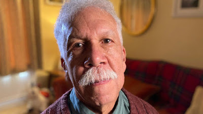
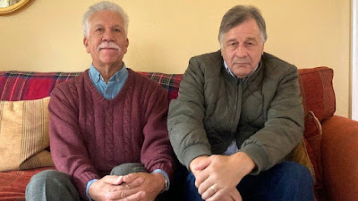
Best friends Eldridge Marriot and Trevor Everett grew up together in Tostock, where they still live today.


As the pair, now aged in their 70s, reminisce over summers spent playing on the village green, it is clear they have a deep connection.


They were two of 14 children in the village, and about 2,000 across the UK, born to white British mothers and black American soldiers during World War Two.


"We definitely stood out with our curly hair," Eldridge laughs. "But we didn't have any racial problems; we were never treated differently."


"We had some good times and I've had a brilliant life, I wouldn't change it for nothing," Trevor adds.


Eldridge says he would have loved to have met his father


As small boys they played in the woods by Tostock Hall, a large house taken over for the war effort, where their fathers were stationed a few years before.


It was very exciting for the village, near Bury St Edmunds, when the soldiers arrived in 1943, Eldridge says.


About 240,000 of the three million US troops, who began arriving in the UK in January 1942, were black.


It was the first time many British people in rural areas had seen a black person.


The US servicemen were mainly helping build airbases, such as Lakenheath and Mildenhall, but in nearby Tostock they were asked to look after Italian prisoners of war at the hall.


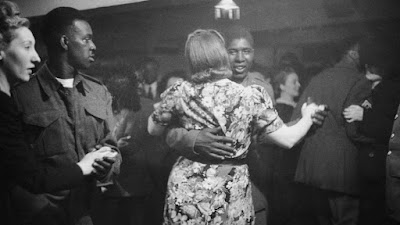
Dances were held at a ballroom attached to the house, where many romances began.


Eldridge and Trevor bonded as children over having absent fathers who were black US serviceman


"A lot of them figured they'd got nothing to lose anyway, they could just disappear back to the States," Eldridge says.

His mother Olive was already married to a merchant seaman who was away at war when Eldridge was born in November 1944. Two months later, his father William Ellis - known as Willie - "disappeared to France, never to be seen again".


When Olive's husband came back and discovered the baby, he said they could only stay married if she put Eldridge into care. Olive refused and they got divorced, while Eldridge went to live with his grandparents.


"My mother wasn't in a position to bring me up," Eldridge says. "She used to come over every Tuesday throughout her life. We never spoke about my father - it was a closed shop.


"My grandfather talked about my father a lot, he liked him. The circumstances were I was left behind and they had to bring me up but they didn't bear any malice at all."


Eldridge's aunt and uncle also lived in the family cottage while he was growing up and he was "spoilt rotten" by them and his grandparents. He later built a house at the end of the garden where he still lives today with his wife.


"All my life I've been on this patch of land. I've had a really good life. It's difficult to see how it could have been any better," he says.


British authorities tried to discourage relationships between white British women and black troops but many romances began at dances like this one in London in July 1943


Trevor was born a few years after Eldridge and the others, in 1946, after his father Paul Woods left his post in France to go back and visit Trevor's mother.


"He got in a lot of trouble for that. He used to climb up a drainpipe to see her; it was very exciting," Trevor says.


His father, who he describes as "half-Indian, a native American" was born in Atlanta and later moved to Maryland.


Trevor still has seven years' worth of letters from his father to his mother, who brought Trevor up and later remarried.


"My mother used to worry someone would come and take me away so she was ever so protective of me. She used to watch me wherever I went," he says.


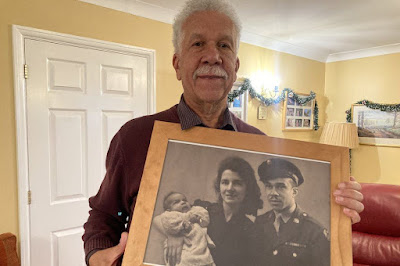
Eldridge's wife had this treasured photo produced for his birthday - a picture of his father Willie superimposed on to a photo of his mother Olive holding him as a baby


Both men grew up in loving homes but that was not the case for many of the so-called Brown Babies - the term given by the African-American press to these children born during the war.


Black troops were not allowed to marry their pregnant white girlfriends and many of the children were given up for adoption, according to Prof Lucy Bland, from Anglia Ruskin University, who interviewed 50 of them for a book called Britain's Brown Babies.


Many of them experienced racism and were shunned by society, like Babs Gibson-Ward. Her mother told her white naval officer husband that Babs was his daughter, until her skin darkened at six months old and the lie was revealed.


She was sent away from her family in Ipswich to live in a children's home until a foster family came forward, but local children avoided her and teachers refused to educate her.


Speaking on The Localist - Suffolk podcast, Prof Bland says: "Nearly half of these babies were put in children's homes. They were often lied to and told their fathers were dead and that their mothers didn't want them.


"They were often called names and didn't understand. Some of them didn't even realise they were a different skin colour; no-one was explaining it to them."


Very few of them were adopted. Officials said it would be impossible to place mixed-race children and the government blocked adoptions from the US, worried they would be seen as dumping them there.


Leon Lomax was one of only a few of the children who went to the US to be brought up by his father, Cpl Leon Lomax.


He arrived back in Ohio at the end of the war with a confession for his wife Betty - he had fathered baby Leon, who was born in Chelmsford, Essex in December 1945.


"As a kid I wondered 'why hasn't my mum tried to find me?,'" says Leon, speaking on the phone from his home in Ohio.


He had a difficult upbringing with his father, who never told him who his mother was or even that he was mixed race.


"I figured I was just black basically," he says. It was only when he had children of his own that he decided to find out more about his heritage.


Leon managed to trace his mother to England, but sadly she had died two years previously.


"I found that I had a sister, Pauline. She said our mother was always nervy around Christmas time and Pauline didn't know why, but I was born on 17 December. My mother never shared anything with her about me," he says.


He recently found a letter his mother had written to his father 75 years ago, detailing her visits to him in the children's home before he was flown to the US.


"She wanted to keep me but could not afford to. I smiled at her for the first time and she was really happy," he says, his voice thick with emotion. "I cried when I read that. It closed a circle for me."


Trevor and Eldridge both decided to trace their fathers when they grew up. Trevor traced his to the US in 1987 with the help of the Red Cross and flew out with his family to meet him.


"He worked in a military hospital and he took me to meet all his friends - he was proud. He used to say he had a son in England, but nobody would believe him."


Trevor spent two days with his father, who was then aged 68, but tragically on his third day out there, his father died.


"I was waiting for ages in this hotel and I thought he didn't want to know anymore," Trevor says. "But then his friend drove up and said 'we've got some bad news, your father died in the night'.


"He died in his chair. They said he died from being overjoyed."


Trevor was pleased to be able to attend the funeral but wishes he had got a photo of them together before he died.

"I didn't get the chance to ask all the questions I wanted to ask," he adds.


Eldridge recently traced his family to Los Angeles, but his father had died in 2004 at the age of 89. He discovered a half-sister called Elsie who was born before him and didn't know of his existence.


"She wasn't really shocked," Eldridge says. "Our father used to tell her he enjoyed his time in Europe. She still lives in the same house as he did.


"Elsie says I look just the same as he did when he was in his 70s," he adds.


Eldridge had always presumed his father was married with children so he didn't attempt to make contact earlier, concerned he would "intrude and spoil his life".


"He was married to his wife for 60 years and kept me a secret all that time. There was nothing he could do. He couldn't say what he had done."


Eldridge says he would have loved to have met him and asked about his time in Tostock.


His son is going to LA to meet Elsie and her family later this year and Eldridge is excited that they are all planning to come to Tostock next year.


And finding Elsie has solved a mystery that has puzzled him for his whole life.


"I always knew my mother in deep Suffolk would never ever have called me Eldridge, and I thought it must come from my father [Willie Ellis]," he says.


"Eldridge was his name at birth. So he obviously picked my name.


"It's a bit unusual, isn't it?" he adds proudly.


(Source: BBC)

Sunday, 17 October 2021

Gulf rupee: When the Reserve Bank of India played central banker in West Asia

 Even after Indian independence, the rupee was the legal tender in a few Persian Gulf states. It was replaced with the Gulf rupee in 1959 to curb gold smuggling.

When an Indian traveller wanted to visit certain Persian Gulf sheikhdoms in the 1950s, there was no need to stock up on foreign currency before the journey since the Indian rupee was the legal tender in these countries. For almost all financial transactions, the United Arab Emirates (then known as the Trucial States), Kuwait, Bahrain, Oman and Qatar used the rupee. The system was put in place by the British when they ruled India. But the arrangement suited the Reserve Bank of India as well, as the Gulf countries would purchase the rupees with pound sterling, against which the Indian currency was pegged.


By virtue of the system, India had economic clout in the Persian Gulf states that were still British protectorates and years away from a major oil boom. However, smugglers and other criminals saw it as an opportunity to make money from the average Indian’s desire to hoard gold.


Indranil Mukherjee/AFP


The modus operandi was quite simple. Smugglers would send young men to the Gulf on ostensible business trips with wads of rupee notes. There, gold would be purchased with the smuggled rupees and brought back to India. This would inevitably create an excess of Indian currency in the Gulf, leading to the extra rupees being sold back to the RBI, which lost valuable foreign exchange.


As is the case now, gold smugglers were very innovative in their methods to bypass Indian Customs officials. A well-known and often-repeated anecdote among the first generation of Malayali migrant workers in the Gulf tells the story of a man who was asked by an acquaintance to take a clock back to Bombay from a Gulf country. The unsuspecting young man carried the clock, inside which gold biscuits were neatly hidden, and was arrested and prosecuted in India.


“While the smuggling had been a problem for many years, in 1957 and 1958 the problem rose to alarming proportions and took a large toll on India’s reserves of foreign exchange,” Peter Symes, an Australian researcher and expert on paper money, wrote in a 1999 article.


A New York Times report from April 1959 stated that India had to pay the equivalent of $92.4 million in sterling for rupees presented through traders and banks in the Persian Gulf in 1957 alone. The report estimated that $69.3 million went to the region from India in exchange for smuggled gold in the first nine months of 1957.


Launch of the Gulf rupee

By 1959, India faced a major foreign exchange crisis thanks to the thriving gold smuggling business, losing hundreds of millions in sterling.


“To obviate or at least mitigate malpractices, which such an arrangement could give rise to, a separate series of notes exclusively for circulation in the Gulf (Kuwait, Bahrain, Qatar, and the Trucial States) were issued by the Indian Government and the Reserve Bank of India in the 1950s,” according to the RBI.


On May 1, 1959, Indian President Rajendra Prasad gave his assent for the Reserve Bank of India (Amendment) Act 1959, after it was passed by both houses of the Parliament. The law allowed the Indian government and RBI to issue special notes that were intended to be circulated only in the Gulf region. This currency, which had the same value as the Indian rupee, was known as the Gulf rupee or External rupee.


One Gulf Rupee. Wikimedia Commons [CC0 1.0]


“The Ministry of Finance drew up the reform after months of secret consultations and after obtaining the approval of the British Government, the Bank of England and the rulers of the sheikhdoms,” the New York Times reported after the Lok Sabha passed the bill.


Shrouded in secrecy, as was the case with the 2016 demonetisation in India, few members of the ruling party knew that this reform was being planned. The task was entrusted to Morarji Desai, then the minister of finance. The bill was introduced in the Lok Sabha on April 27, 1959.


“The introduction of the amendment to the Reserve Bank of India Act, to the Indian parliament, caused some consternation to the members of parliament, as it was proposed without any warning,” Symes wrote. “The Government of India had tried to introduce the amendment with a degree of haste so that they could reduce the window of opportunity for people who might take advantage of the proposed issue of special notes and increase the smuggling activity in the immediate future. However, following a delay of a day or so in which the opposition was allowed to review the measures, the amendment to the Act was passed with little difficulty.”


The Gulf rupee notes retained the contemporary design but were different in colour and carried the prefix “Z”. The notes were issued one, ten and hundred denominations and were redeemable only at the Bombay office of issue.

Holders of regular Indian currency notes in the Gulf were given six weeks to exchange them for the new currency or sterling. The transition to the new notes was fairly smooth and regular rupee notes were no longer accepted in the Gulf. Innovative gold smugglers, however, found other ways to satiate the Indian appetite for the precious metal. At the time of the passing of the bill, Indians were believed to be privately hoarding up to $2 billion in gold.


Haj notes

Indian pilgrims also took rupee notes when they went on the Haj pilgrimage, where they could freely exchange them for Saudi riyals. The Indian government had initially allowed Saudi banks and traders to exchange these rupees for sterling in Bombay, but fears persisted over smugglers using this route to buy foreign exchange.


In response to this threat, the Indian government began to issue special Haj rupee notes for pilgrims going to Mecca and Medina. The notes in ten and hundred denomination had the word HAJ inscribed on the obverse. Another way to distinguish them from normal rupee notes was the serial number that was prefixed with the letters “HA”.


The Haj rupee was exchanged at par to the Saudi riyal in the early 1960s. (A Saudi riyal is now worth almost 20 rupees.) Haji Siddique Mohammed, a 79-year old retired railway employee from Mangalore, remembers using the Haj rupee during a pilgrimage in 1963. “We got the Haj rupee from the Haj Committee of India, before boarding the ship for Jeddah,” Mohammed told this writer. “I managed to preserve a couple of notes, but they were unfortunately lost when I moved out of my official quarters after retirement.”


Devaluation of the rupee

The special notes for the Haj and the Gulf stayed in circulation until the mid-1960s but were slowly being phased out in some countries. This was at a time when Indian economic growth was slow, and the Gulf nations were in the early stages of a boom. Kuwait introduced its own currency as early as 1961 and a few years later, Bahrain followed suit.


The end of the Gulf rupee was, however, precipitated by an important development in India. In June 1966, Indian Finance Minister Sachindra Chaudhuri, with the blessings of Indira Gandhi, announced a devaluation of the rupee. Overnight the exchange rate of the dollar rose to Rs 7.5 from Rs 4.76. Although this decision surprised many, rumours were doing the rounds for several months.


A World Bank team that had visited India in 1965 proposed the idea of devaluation of the rupee to get the economy moving. Media reports of the time suggested that devaluation was one of the West’s preconditions for increasing aid for India’s fourth five-year plan. The decision prompted members of the opposition and the business community to accuse the government of bowing to pressure from the United States and multilateral lending institutions.


The devaluation created a stir in West Asia, with some rulers asking the British government to intervene, since the original arrangement to rely on the Indian rupee was put in place by the British. Such requests were turned down.


Qatar and Dubai withdrew the Gulf rupee from circulation within months of the devaluation of the Indian rupee, with both states temporarily using Saudi riyals. They would subsequently use Qatar and Dubai riyals, which had the same value of the pre-devaluation Indian rupee. Most of the Trucial States followed suit, but Abu Dhabi decided to use the Bahraini dinar, which had an exchange rate of 10 Gulf rupees.


A bank in Al Ain, southeast of Dubai. Dubai withdrew the Gulf rupee from circulation within months of the devaluation of the Indian rupee in 1966. Credit: WAM/AFP


“Consequently, following the introduction of the Qatar and Dubai riyal, the Qatar and Dubai Currency Board made a claim to the Reserve Bank of India for the total amount of sterling originally sent to cover the rupees held by Qatar and Dubai, and not the lesser value of what the Gulf rupees were actually worth,” Symes wrote.


The RBI would deal with each of the Gulf states separately when it came to the settlement of the sterling reserves that it held.


The RBI-issued currency survived in Oman until 1970 and was mostly accepted as legal tender only in the country’s ports. In May 1970, the Saidi rial (named in honour of the House of Al Said) was introduced as a currency in Oman and replaced the Gulf rupee. The new currency was exchanged at par with the sterling. Gulf rupees were exchanged for 21 rupees to the riyal and were redeemed in Bombay by the Omani government. The country’s present currency the Omani rial became the legal tender in 1972.


The Haj and Gulf rupee notes were withdrawn by the RBI in the early 1970s and are now a much-sought after collector’s item. Auctions conducted by Spink & Son have managed to get bids from 120 pounds and VAT for a 10 Gulf rupee note to 44,000 pounds for a 100 Haj rupee note. Collectors and enthusiasts warn of several fake notes being sold for high prices on different e-commerce websites.


Five decades after the Gulf and Haj rupees have ceased to exist, India continues to enjoy strong business and cultural links with Persian Gulf states but the idea of the country getting back the economic clout that newly-independent India enjoyed in West Asia does not look realistic.


Ajay Kamalakaran is a writer and independent journalist, based in Mumbai. He is a Kalpalata Fellow for History & Heritage Writings for 2021.


(Source: Scroll)

Thursday, 14 October 2021

Mahatma Gandhi disagreed with Rabindranath Tagore on many things. Here’s where they agreed

 An excerpt from ‘Tagore and Gandhi: Walking Alone, Walking Together’, by Rudrangshu Mukherjee.

In spite of the divergence in their philosophical and spiritual perspectives, there were some fundamental issues on which they were in complete agreement. These are no less important. One was their commitment to service which was at the core of what Rabindranath, in his first letter to Gandhi, referred to as their common sadhana. Gandhi embodied service to the people. This was his calling, his life. He could thus say towards the end of his life, “My life is my message.” He made dedicated service for the common people a “talisman” for decisions, policies, etc.:


“I will give you a talisman. Whenever you are in doubt, or when the self becomes too much with you, apply the following test. Recall the face of the poorest and the weakest man whom you may have seen, and ask yourself if the step you contemplate is going to be of any use to him. Will he gain anything by it? Will it restore him to a control over his own life and destiny? In other words, will it lead to swaraj for the hungry and spiritually starving millions? Then you will find your doubts and yourself melting away.”


Gandhi’s commitment to service is so well known, it does not need any reiteration, but Rabindranath’s work in this sphere is less noticed as he is seen more as a creative artist.


Rabindranath Tagore and Mahatma Gandhi.


From the time he began touring parts of the Bengal countryside to look after his family’s landed estates, he became concerned and then involved with the welfare of the people who lived in the villages. He wrote about these problems in his essays [...L]ater on in his life he devoted himself to the welfare and the development of villages around Santiniketan. His aim was to structure the economy of these villages to make the people self-reliant in an environment whose principle would not be self-interest but co-operation. He wrote:


“The symptoms of our miseries cannot be removed from the outside, their causes must be extirpated from within. If we wish to do this, we must undertake two tasks; first to educate everyone in the land, so as to unite them mentally with all the world...Secondly, to unite them among themselves in the sphere of their livelihood, so as to bring about their union with the world through their work.”


Rabindranath’s concern and dedication to service to the poor was reflected in his creative work – especially his short stories and in some of his novels. Witness Gora’s restless endeavour to work among and for the poor; and also the depiction of the character of Jethamoshai (uncle) in the novel Chaturanga.


For both Gandhi and Rabindranath, the dedication to service for the poor was integrally connected to their vision of swaraj. Neither of them understood swaraj as mere political freedom from British rule. This political freedom was to be complemented by the emancipation of human beings.


What constituted this dimension of swaraj? It was constituted by the ability and the empowerment of individuals to regulate and run their own lives independent of external institutions like the state. Individuals should have the strength to fearlessly conduct their own daily lives. Gandhi emphasised abhaya (fearlessness) and Rabindranath atmashakti (soul force) – the two notions were inseparable and could only grow out of service and responsibility. Rabindranath wrote, “For India, true freedom is social freedom: the freedom to do good...”


Rabindranath expressed his vision of swaraj in a famous song which roughly translated goes as, “We are all kings in the kingdom of our king”. If everyone was sovereign, there was no necessity for a king. Gandhi approximated to the same idea through his vision of “enlightened anarchy”. He wrote in January 1939:


“Political power, in my opinion, cannot be our ultimate aim. It is one of the means used by men for their all-round advancement. The power to control national life through national representatives is called political power. 


Representatives will become unnecessary if the national life becomes so perfect as to be self-controlled. It will then be a state of enlightened anarchy in which each person will become his own ruler. He will conduct himself in such a way that his behaviour will not hamper the well-being of his neighbours. In an ideal State there will be no political institution and therefore no political power.”


Their vision of swaraj was embedded in ahimsa – another idea that converged in the sadhana of Gandhi and Rabindranath. For both of them, ahimsa represented a moral force which in India was pitched against British rule. It was, however, a moral force for the whole of humanity. Both had stood on the principle of ahimsa and had withdrawn from movements in which they had played a critical part when they saw those movements deviating from non-violence and deploying coercion and violence.


It was in one such conjuncture during the Swadeshi movement that Rabindranath had stepped aside from the movement and in great mental anguish composed that memorable song, “Ekla cholo re”. If no one answers to your call, walk alone. Gandhi made this song his life’s motto and lived it when he walked away from the Non-cooperation Movement after the violence at Chauri Chaura and then again in the last months of his life when he refused to be part of negotiations to partition India and walked away alone to Noakhali to pursue his life’s calling of service to the poor, of ahimsa, and abhaya.


Since ahimsa was one of the pillars of their lives, Rabindranath and Gandhi saw India (and the world) in terms of harmony, free from hatred of any kind, religious and racial. Their idea of India was inclusive and assimilative, and they were anguished when they saw that idea and ideal of India being ripped apart by sectarian violence.


Rabindranath was spared the tragedy of witnessing Partition and the communal violence that preceded and followed it. He had to suffer though the spectacle of global violence in the months before his death. Gandhi had to live through the violence of Partition, and according to those who knew him, was never quite the same person after that experience. He told Nirmal Bose towards the end of his life, “I don’t want to be a failure. But I may be a failure.” As an apostle of non-violence he fell a victim to violence.


Through the expressions of difference and respect for each other, Gandhi and Rabindranath set an example of debating and deliberating on public, social, and political questions. They formed a legacy of public reasoning. They debated without acrimony. This is an essential constituent of the Gandhi-Rabindranath heritage – a beacon as India walks the razor’s edge to fashion a society that is inclusive, free of bigotry and hatred, and informed by civilised discussion and discourse. Through their words and their deeds Rabindranath and Gandhi taught us to:


“...Sing with mortal voice...unchanged ...
Though fallen on evil days,
On evil days though fallen and evil tongues;
In darkness, and with dangers compast round,
And solitude; yet not alone...” 


Excerpted with permission from Tagore and Gandhi: Walking Alone, Walking Together, Rudrangshu Mukherjee, Aleph Book Company.


(Source: Scroll)