Showing posts with label Indians. Show all posts

Tuesday, 24 May 2022

How tall will Mount Everest get before it stops growing?

 Arching over 8,849 metres (29,032ft) into the sky, Everest is the world’s tallest mountain. But will it always be?

Aurora Elmore was approaching Mount Everest's South Base Camp in Nepal. But rather than taking the traditional 12-day hiking route, she was soaring between the frozen peaks, the rotor blades of her helicopter slicing through the thin air with a whap, whap, whap.


It was April 2019, and she was delivering supplies to a team of scientists working on the slopes of the world's tallest mountain. Her reward was a spectacular view: the day was crystal clear, exposing the entire Himalayan range.


Over the next two months, researchers on the National Geographic and Rolex expedition she helped to organise would study the effects of climate change on this part of the Himalayas. Elmore, a geologist and at the time senior programme manager of the National Geographic Society in the US, supported the team installing the world's highest weather station on the flanks of Mount Everest. During the course of their expedition, her colleagues discovered the world's highest evidence of microplastic pollution in snow and stream water close to the summit. 


Gliding closer to Everest's iconic peak, Elmore got a bird's-eye view of them. A miniature city of green and yellow tents, each sheltering mountaineers headed for the top, had formed at Everest Base Camp more than 5km (3 miles) above sea level. Thousands flock to Everest every spring to make an attempt to reach the roof of the world.


And while few of the climbers would have noticed, Everest grew a tiny bit bigger during their time on the mountain.

Mount Everest, along with the rest of the Himilayas, inches further skyward every year. It raises an interesting question – with enough time, just how tall can Mount Everest grow? There are mountains on other planets in our Solar System that dwarf those on our own, so are there limits to how big a mountain can get on Earth?


Mount Everest towers 8,848.86m (29,032ft) above sea level, according to the most recent official joint survey by China and Nepal, whose borders run across its summit. But it isn't the only giant in these lands – 10 of the world's 14 peaks higher than 8,000m (26,247ft) above sea level can be found in the Himalayan range. Everest, Elmore says, is among friends. "If you've ever flown over Greenland or the Canadian Rockies you can see big mountains, but [the Himalayas] are just on another level," she says.


Surrounded by so many other enormous peaks, is it possible to discern just what a monster Everest is? Elmore hesitates before answering. "It's kind of like trying to tell the tallest person on a basketball team," she says finally. "They're all tall, but which one is the teeny [bit taller]?"


The history of measuring the tallest mountain in the world stretches back to 1852. In Europe, Charles Dickens was publishing serialised instalments of his novel Bleak House. North America had started testing its first steam-powered fire engine. In Asia, the height of Mount Everest was a mystery. It was known only as "Peak XV". Radhanath Sikdar, an Indian mathematician, had been employed by the British to work on their Great Trigonometrical Survey. They wanted to gather a more accurate geographical picture of the territory they were occupying so they could control it more effectively, be it for trade or military purposes.


Sikdar used trigonometry. He measured the horizontal and vertical angles of Everest's summit from other mountaintops whose positions and heights were already known. In doing so he made a momentous discovery: the tallest mountain ever recorded. According to his calculations, the mountain stood at 8,839.8m (29,002ft) tall.


Though the technology behind measuring mountains has advanced since the 1850s, his figure was astonishingly accurate, just nine metres off the latest official height. Despite Sikdar's findings, the mountain eventually was named after his previous boss, British surveyor Sir George Everest, who had retired several years before Sikdar's discovery.


At more than 8,848m (29,032ft) tall, Mount Everest towers over the other giants in the Himalayas (Credit: Getty Images)


Since then, teams have continued to work to understand Mount Everest's height. In 1954 an Indian survey determined Mount Everest to be 8,848m (29,029ft) tall, a figure which was accepted by the Nepalese government. But then, in 2005, the Chinese measured it at 8,844.43m (29,017ft) – nearly four metres (13ft) lower. In 2020, teams from China and Nepal jointly agreed upon a new officially accepted height that was 0.86m (2.8ft) higher than the Survey of India's original calculation. 


While these changes in the measured height are partly due to improvements in the measuring technology available to surveyors, there has also been some politics involved. China and Nepal historically have argued over whether the snow cap on the summit should be included in the measurement or not.


But we mustn't ignore that Everest also grows a tiny little bit taller every year too.


Once, the craggy limestone peaks that skim the sky of Everest were on the ocean floor. Scientists believe it all began to change about 200 million years ago – at around the time the Jurassic dinosaurs were beginning to emerge – when the supercontinent of Pangea cracked into pieces. The Indian continent eventually broke free, journeying north across the vast swathe of Tethys Ocean for 150 million years until it smacked into a fellow continent – the one we now know as Asia – around 45 million years ago.


The crushing force of one continent hitting another caused the plate beneath the Tethys Ocean, made of oceanic crust, to slide under the Eurasian plate. This created what is known as a subduction zone. Then the oceanic plate slipped deeper and deeper into the Earth’s mantle, scraping off folds limestone as it did so, until the Indian and Eurasian plates started compressing together. India began sliding under Asia, but because it's made of tougher stuff than the oceanic plate it didn't just descend. The surface started to buckle, pushing the crust and crumples of limestone upwards.


Weather stations installed on Mount Everest were damaged by rocks the size of cricket balls that were picked up by the wind


And so the Himalayan mountain range began to rise skyward. By around 15-17 million years ago, the summit of Everest had reached about 5,000m (16,404ft) and it continued to grow. The collision between the two continental plates is still happening today. India continues to creep north by 5cm (2in) a year, causing Everest to grow by about 4mm (0.16in) per year (although other parts of the Himalayas are rising at around 10mm per year [0.4in]).

But understanding how and why Everest's height changes is more complex than just this. While plate tectonics push the summit higher into the sky, erosion claws away at it.


To understand this process better, scientists studied another mountain some 8,700km (5,405 miles) away from Mount Everest, in Alaska.


Rachel Headley, an associate professor of geosciences at the University of Wisconsin-Parkside, was part of a scientific expedition to Mount Saint Elias on the border of Alaska and Canada between 2005-2008. The mission intended to understand the complex roles of tectonics and erosion in how mountains grow and shrink. The second largest mountain in both Canada and the US, Saint Elias faces the same effects as Everest, from tectonic activity to erosion, but across a far smaller, more manageable area. "In that region, Alaska, there were very particular weather patterns that had helped these large glaciers grow," Headley says. "And then both glaciers and rivers, landslides, and avalanches were all kind of the processes that connected to tear them down."


Headley's role on the team was to understand the thickness of the Seward Glacier, which runs through the Saint Elias mountains, and how fast it was moving. Both can impact the rate of erosion, which can affect how quickly a mountain's height is worn away. "If we have a thinner glacier, and it's moving super fast… we know there has to be some sliding, which we think is really important for erosion," she says. "Sliding" can cause glacial abrasion, which is when the glacier drags rock fragments across the surface as it moves, creating a sandpapering effect.


Weather can also cause significant erosion to a mountain. Elmore describes one of the weather stations she helped install during the 2019 Mount Everest expedition as being "damaged by rocks the size of cricket balls that were picked up by the wind and thrown at it". Buffetting by debris and ice picked up by the wind takes its toll after a while.
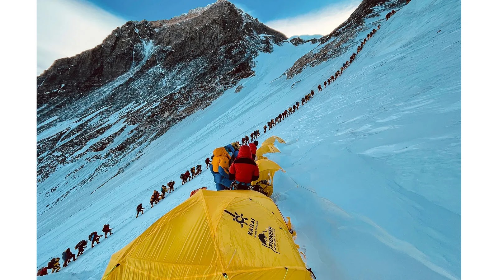

The main routes up Mount Everest have now become so popular with climbers that long queues can form (Credit: Lakpa Sherpa/AFP/Getty Images)


Many of the highest peaks in the world, including Everest, have permanent snow caps that help protect them from this wind-blown barrage. Rock covered in a soft blanket of snow suffers less weathering and erosion than bare rock, says Headley. It also protects the rock from chemical reactions with the air that can gradually degade the minerals in the limestone that comprises much of the uppermost parts of Mount Everest. But there are still places where the rock is exposed to the elements.


"For a tall mountain range, you can basically get to such a steep angle in the rock that it can't actually support ice, and snow, and then you start to get avalanches, and you get bare rock," says Elmore. Rock falls and land slides – a constant hazard on Everest and the surrounding area – both play a role in shaving away at Everest's height, and rivers too. They have been estimated to be cutting gorges into the rock at a rate of between 4-8mm (0.2-0.3in) a year.


But the exact impact erosion has on a mountain's height is still to be understood. Some scientists believe that reducing the weight of a mountain (by taking away the snow, ice and rock it's made of) might actually allow the tectonic plates to push the, now lighter, mountain even further into the sky. 


Headley's colleague Terry Pavlis, who was the lead investigator on the St Elias Erosion Tectonics Project (Steep), explains that, on a large scale, "erosion attacking a landscape allows it to rise up".


In some parts of the world, entire landmasses are still rearing up after the last ice age – something known as isostatic rebound. Parts of North America and northern Europe, including Scotland, are rebounding after the rocky crust there was squashed by enormous continental ice sheets that waxed and waned during the Pleistocene. According to one study by researchers at Germany's University of Postdam, up to 90% of the uplift in the European Alps can be explained by this surprisingly elastic response to the end of the ice age. Experts believe similar glacial isostatic rebound may have taken place on the Tibetan Plateau and in the Himalaya as the ice age glaciers receeded – contributing between 1-4mm (0.04-0.16in) a year to the uplift.


"But there's some kind of equilibrium between how fast that landscape can erode and how high those peaks can get," adds Pavlis.


The exact details of this equilibrium are still being explored. In a region like the Appalachians in north-eastern North America, or the Scottish Highlands, erosive forces like rivers and landslides are cutting mountains down lower and lower, Headley says. "But in regions with tectonic activity, the tectonic force can be driving the mountains up slower, faster, or at around the same rate as the erosion is cutting it down. We don't fully understand all the drivers in those types of systems."
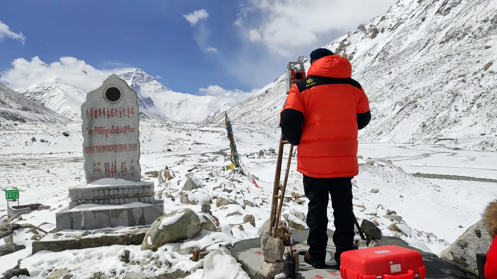

The most recent official height for Mount Everest was agreed following Chinese and Nepalese surveying expeditions to the summit (Credit: VCG/Getty Images)


So how are mountains actually measured nowadays? One of the most common instruments used is the Global Navigation Satellite System (GNSS), which records the precise position of the mountain peak using a network of satellites. GNSS can "measure heights to the millimetre," according to Pavlis. The challenge, for a mountain like Everest, has always been the weight of the equipment. "It's hard enough to get to the peak – try adding a 30lb (13kg) instrument," he says.


A helicopter taxi to the top with the heavy luggage is out of the question – the thin air around Everest's summit means the engine can't produce enough power and there's too much drag from the rotor blades to operate safely. The strong winds and jagged creeks also make touching down anywhere near the summit dangerous. One helicopter pilot did set a world record by touching down briefly on top of Mount Everest in 2005, but only after the manufacturer stripped it bare of every unessential item to make it feather light.


Luckily, GNSS systems have gotten smaller over the years. Now they weigh more like 1.2kg (2.6lbs) and are "about the size of a lunchbox, maybe a little smaller", says Pavlis. But the devices still need batteries, which can struggle in cold temperatures. The average temperature at the summit of Everest during the summer monsoon months is a balmy -19C. And there are other complications too. "There's an antenna that's about, you know, half a metre in diameter. And those have to be set up somehow so that they are absolutely stationary," Pavlis explains. 


To gather millimetre-accurate results the instrument then has to record for several hours. In the thin air of Everest's "death zone", operating these instruments can be hazardous for surveyors. Members of a Nepalese expedition to take GNSS measurements on Everest in 2019 spent two hours on the summit – far longer than most who make their way there – after arriving at 03:00 in the pitch black and biting cold.


Another option, often used in addition to GNSS for the most accurate readings, is Ground Penetrating Radar (GPR). "GPR uses radar pulses to image below the surface, so it can tell us the thickness and internal structure of snow and ice overlying the rocks on Everest's summit," says Elmore. "There's something like 4m (13ft) of snow and ice on the top of Mount Everest, but that can change depending on the climate."


The mountain that measures the greatest distance from the centre of Earth to its peak is Chimborazo in Equador, at 10,920m (35,826ft)


While Elmore and her team were conducting their own scientific experiments on Everest they leant the Nepalese expedition a GPR device so they could take measurements from the summit. "It had to be a specific design of GPR, one that was super lightweight so [it could be carried] to the top of Everest, but that also had the right transmitter and receiver to measure the ice," says Elmore. The device had recently been used at the summit of Denali, the tallest mountain in the US, so they knew it was up to the job.


Despite the many hurdles they faced, the Nepalese team's expedition to measure the height of Everest was successful. They had hoped to answer questions about whether a deadly 7.8 magnitude earthquake that hit Nepal in April 2015 had affected Mount Everest's height. Initial reports indicated the mountain had shifted 3cm (1.9in) to the south-west by the large earthquake, which killed 9,000 people and damaged hundreds of thousands of homes, but had not changed its height.


The project, however, soon became muddied with international politics. A few months later a team of Chinese surveyors conducted their own measurements during an expedition from the other side of the mountain. They had their own figure, which didn't include the snow cap. The Nepalese figure, on the other hand, did. In October 2019, the two countries decided to combine their data and in December 2020 they released the figure for the new official height – 8,848.86m (29,032ft), including the snow on top.


As China and Nepal found, deciding exactly what you measure, and how you measure, is fundamental to establishing a mountain's height. For example, to agree upon how tall a mountain is, we must first agree on where the bottom is. But that's not as easy as it might sound.


For centuries mountains have been measured using sea level as the base from where their height is calculated. But the Earth is not perfectly round: it bulges along the equator. And sea level isn't static, it is pulled and changed by our planet's gravity. Plus, Everest isn't sticking out of the ocean, it's nestled among a landscape of other mountains. 


Many complex calculations have to be done to establish where sea level would actually be, and Everest's relative height to it. When that starting point is changed, everything changes.


The Himalayas began rising around 45 million years ago as the Indian and Eurasian continental plates collided (Credit: Rik Olde Engberink/Alamy)


But let's say scientists started their measurements from the core of the planet instead. Everest would no longer be considered the tallest mountain on Earth. The mountain that measures the greatest distance from the centre of Earth to its peak is Mount Chimborazo, in Equador at 10,920m (35,826ft). What about starting from the seabed? The accolade of tallest mountain would then go to Mauna Kea, a volcano in Hawaii that arches 10,000m (32,808ft) from the ocean floor.


Looking beyond our own planet, we can see examples of just how enormous mountains can become. Olympus Mons, a volcano on Mars, towers 21km (19.2 miles) into the sky and stretches 624km (388 miles) wide. It is roughly the size of the state of Arizona. Because gravity on Mars is weaker than on Earth, and because Mars doesn't have tectonic plates shifting and colliding beneath the surface, the ooze of lava that flowed out of the Martian volcano in the planet's past was able to grow to monstrous proportions.


Could Everest become a similar giant? In the 1980s, a researcher at the Cavendish Laboratory in Cambridge, UK, attempted to estimate what such a limit might be on Earth, taking into account the strength of gravity and the strength of the rock underlying the mountain. The calculations, which made "no presensions to serious geophysics" estimated the theoretical maximum height of a mountain range with a granite base – as Mount Everest largely has – to be 45km (28 miles) on Earth. 


But there are a number of barriers – apart from our planet's relentless weather – that might stand in the way of this, according to Headley. For starters, "you would eventually run out of your tectonic forces, and then it would stop growing", she says. Scientists believe that eventually the Earth's mantle will cool to such a degree that the planet-wide dance of plate tectonics will end. Until then, earthquakes and landslides will also erode away the mountain too.


"At some point, [the mountain] becomes so steep that it's unstable and chunks start falling off," Elmore says.

With the wind, snow and ice buffeting, cracking and splitting the rock, Everest is unlikely to ever reach the sizes seen on Mars. "We have our weather systems, and weather is really good at creating erosional forces," Headley says. "Basically, the fact that we have water, whether in the form of ice or snow, or just rain, is what really can limit mountain growth."


For now, Everest keeps edging, bit by bit, into the sky as other forces try to tear it down. Elmore's 2019 team discovered global warming was yet another of these, driving considerable thinning of the snow and ice on the upper reaches of the mountain in recent decades and revealing more bare rock to the erosive impacts of weather.


Olympus Mons, a volcano on Mars, towers 21km (19.2 miles) into the sky and stretches 624km (388 miles) wide


Everest is also far from being the fastest-growing mountain on our planet. The closest contender for the top spot is perhaps Nanga Parbat, a neighbour to Everest located in the Pakistani Himalayan range, which is 8,126m (26,660ft) tall and growing at 7mm (0.27in) per year. In 241,000 years it could overtake Everest to be the tallest mountain on Earth, provided rates of erosion don't change.


Others, such as those in the Swiss Alps, are also growing rapidly thanks to an imbalance in the amount of erosion taking place. Scientists found that uplift is more than 50 times faster than any negative effects from erosion here. But the Swiss Alps are far shorter than Mount Everest and most studies suggest the mountains there are currently growing at 2-2.5mm (0.08-0.1 inches) per year. 


Meanwhile, Everest retains its allure as a mountain at the extreme of what can be found and endured here on Earth. Its reputation as the highest peak on our planet continues to attract climbers from all over the world, even as its height continues to shift.


Over a video call I ask Billi Bierling, a mountaineering journalist who hiked Everest herself in 2009, whether an extra millimetre, metre or mile higher matters to people like her. She is relaxing on the sofa at her mother's house in Germany, preparing to head back to Nepal for the summer season in March.


"The exact measurement doesn't matter," she says, laughing warmly at my question. "What matters is that it's the highest, and that you go to the highest point. If you're having a bad day, or someone is not very nice to you, or they put you down, you can think to yourself, you know what? I've climbed Everest."


For most who reach the summit, it is simply being there that counts.


(Source: BBC)

Monday, 18 October 2021

‘No one person gets to limit what it means to be Indian’: Namit Arora, author of ‘Indians’

To write his book, Arora travelled to the seats of the different civilisations of India.


An alumnus of IIT, Kharagpur, Namit Arora spent almost two decades in Silicon Valley as an Internet technology professional. In 2013, he quit his job and returned to India and, almost for two years, he volunteered with the Delhi government to find innovative solutions to civic problems; he led the drafting of Delhi’s solar energy policy and a task force on air pollution. In between, he published two books, The Lottery of Birth: On Inherited Social Inequalities, a non-fiction, and Love and Loathing in Silicon Valley, a novel set in Silicon Valley.


Arora’s third book is about Indian civilization, titled Indians: A Brief History of a Civilization. He spoke to Scroll.in about his journey from tech professional to author, his latest book, and how he looks at the idea of Indianness. Excerpts from the interview:


Tell us something about your journey from a career in internet technology to becoming a published author of two non-fiction books and a novel. What inspired Indians: A Brief History of a Civilization?
I was herded into the “safe” engineering profession by the great forces of the Indian middle-class. Not that I desired something else in my teens. It was actually good for me in many ways. It took me from IIT Kharagpur to California. Earnings from my career funded my wanderlust and evening education in the humanities. But I did see it mostly as a day job that paid the bills.


In the early years, as with most aspiring writers, I too faced my share of rejections in the publishing world, but I lived and learned, and built a nest egg. In due course, I quit the job, returned to India, and persevered until, fortunately, things worked out. Ironically, it was my unloved tech career that financed my new life of full-time reading, writing, travelling and the sporadic volunteer project like drafting the solar energy policy for Delhi – not to mention my labour of love, Indians.


My interest in history really began after leaving India, when life in the US raised for me various questions of culture and identity. In my mid-twenties, backpacking through Mexico in the early 1990s, I was blown away by the ruins of the Mayan and Aztec civilisations. That got me hooked on “lost cities”, or historical sites that were entirely lost to living memory and were dug out by archaeologists. I’ve since visited scores of lost cities around the world.


In the mid-2000s, my partner and I took a break from work to travel in India for two years. That was an amazing experience. We visited over a hundred sites in 20 states, including all of the lost cities I write about in Indians. Each of them raised new questions for me whose answers I could not easily find.


Namit Arora at the site of Nalanda University.


For instance, I wondered what life was like in the city of Dholavira, and what of the Harappan ethos is still with us. What urban milieu produced a great thinker like Nagarjuna? What was a day in the life of a student at Nalanda? What religious worldview promoted erotica on Khajuraho’s temple walls, and why did it disappear? How did the city of Vijayanagar become so rich? Can scoundrels also gain moksha after death in Varanasi? Questions like these.


So I started digging for answers, from which emerged the idea for a book like Indians. I read early travellers and literary-philosophical works, academic histories and monographs, Bahujan and feminist scholars, and Hindu nationalists. I visited site museums and read archaeologists’ reports. I wrote book reviews, essays and travelogues. As I connected the dots, the scope of the project evolved.


What was the transition to the history of Indian civilisation after writing a novel, Love and Loathing in Silicon Valley?
It wasn’t difficult. Though the novel and the history book were published within eighteen months of each other, both books had gestated for over a decade. They proceeded in parallel and became two different modes through which I explored questions of culture and identity, with the hope of gaining a better understanding of my world and my place in it.


The dust jacket of your new book says ‘Indian civilisation is an idea, a reality, an enigma.’ Can you elaborate on this statement?
I think the statement tries to capture the varied, mutating quality of Indian civilisation. Its reality is, of course, borne out by any academic definition of “civilisation”, even as its form and content have never been stagnant or singular. 


Indeed, Indian civilisation has been a journey of profound and continuous change – from the Harappans who built the first cities with indoor toilets and the most egalitarian civilisation of the ancient world, through the dramatic reshaping of the subcontinent’s culture by the Aryan migrants with new languages, religious ideas and the varna system, the rise and fall of Buddhism and Tantrism, the advent of feudalism and Bhakti, and the Turko-Persians bringing Islam and giving rise to a new syncretic culture, to India’s momentous encounter with European colonialism and western modernity.


Not surprisingly, then, Indian civilisation has been different things to different people. For instance, there is no historical evidence that Brahmins and outcastes, or urbanites and Adivasis, or priests and Carvakas, or sultans and peasants, or Tamils and Mizos, took pride in a common idea of Indian civilisation – and is there a good reason to privilege one over the other? Can it not contain many such ideas? With so many coexisting social realities, Indian civilisation is also an enigma that has produced various, often conflicting, appraisals of its central features and qualities. People joke that India frequently confounds academic social science. To adapt Whitman, Indian civilisation is large, it contains multitudes. So it’s all of these at once: idea, reality, enigma.


Different sets of people describe and define ‘Indianness’ in different ways. How do you look at the idea of Indian identity? What according to you are the basic qualifications for being an Indian?
As I see it, anyone who considers herself an Indian is Indian. Period. There should be no further litmus tests, no additional qualifications. “Indianness”, or “Indian identity”, which transcends the citizenship of the modern state, ought to be expansive enough to accommodate all those who consider themselves Indian in whatever ways they see fit, wherever they live. No one person or group gets to limit what it means to be Indian, at least not without a fight. As the poet Rahat Indori memorably said, “Kisi Ke Baap Ka Hindustan Thodi Hai”.


Many books have been written about the history of Indian civilisation by Indians as well as foreigners. How is your book different from them?
I think each reader will see my book as different (or not) in her own way. That said, let me offer a few provisional thoughts of my own. I’d say that Indians is rare in combining narrative history with archaeological travel writing. It’s a non-traditional history. It aims for an engaging, human portrait of our lost cities, in which the traveller (me) is part of the narrative.


It also draws new insights from early travellers’ accounts that speak to our 21st century concerns and sensibilities. In short, it tries to bring alive our forgotten pasts in rich and evocative detail, combining quirky stories with the big picture of Indian civilisation and its evolution. It strives to include non-elite perspectives – the view from below – rare in histories written by non-Indians and upper-caste Indians. Nor do I shrink from controversial topics or avoid calling a spade a spade. It also incorporates significant new research from archaeology and genetics.


According to American historian Hayden White, ‘history is no less a form of fiction than the novel is a form of historical representation’. How do you interpret this statement?
What I hear White saying is that, as narrative forms, history and fiction have more in common than meets the eye. This is a compelling view, though it can be easily misunderstood. I mean, one might object and point out that the historical narrative is built on facts and verifiable events, while the fictional narrative requires nothing more than subjective human experience and imagination, and so these are two very different kinds of endeavours.


But facts are one thing, their interpretation another. Facts alone do not necessarily make the narrative of history more truthful than the narrative of fiction. Indeed, fiction can often reveal our past and present more truthfully and vividly than what facts alone can convey. This is because both types of narratives must also employ significant interpretation – ie, subjective moral and aesthetic choices and judgments – which is what makes them similar forms.


A corollary is that a great historian has much in common with a literary master. Both must attempt to enter the society they reference, to see the world as its members saw it, and understand, to the extent possible, what it was like to live in it. Both require ample sensitivity, imagination, depth of perception, the right distance, and the ability to synthesise vast bits of social knowledge. Both must examine the psychology, morals, aspirations, and assumptions of ordinary people. Neither can claim to be an impartial or omniscient narrator, and so both history and fiction are subjective, value-laden enterprises sharing a family resemblance.


You present insights in your book from the accounts of the Persian traveller, Alberuni, and the French traveller, François Bernier. Both spent more than a decade in India and wrote extensively about their experiences. How do you compare their views about India?
Alberuni visited India between 1017 and 1030, when Mahmud of Ghazni was raiding wealthy temples. Bernier stayed from 1658-69, during Aurangzeb’s first decade as emperor in Delhi. They are two of the most fascinating and perceptive observers of medieval north Indian society. Both espoused a scientific temper and a humanistic ethos. 


Both admired many things Indian but also criticised other things. They each wrote near the eve of a major incursion from outside the subcontinent – Turko-Persian and European, respectively. Like any observer, they too had their biases and blind spots (which I discuss), but they’re still very informative about two different moments in Indian society.


Alberuni, a veritable polymath, had emerged from a great flowering of science and cosmopolitan culture centred in Persia. He despised Mahmud and condemned his raids. He learned Sanskrit in India, studied the major Indian religious, philosophical and scientific texts, translated some into Arabic, and sought out learned Brahmins to clarify his doubts. He praised earlier Indian achievements in mathematics and science, but noted the dismal state of science in contemporary India (for instance, unlike Aryabhata half a millennium earlier, leading Indian astronomers now held that the earth did not rotate on its axis but was at rest).


Caste made a powerful impression on Alberuni. He saw that such birth-based inequalities and segregated living, sustained by both religious scriptures and temporal laws, prevented social solidarity and a sense of common cause. He called it the chief difference between Indians and his own people. He hated the caste mindset of the elites. It bothered him that learned Indians did not mingle with foreigners like him – refusing to sit, eat, and drink with him – for fear of being “polluted”. He saw this as a kind of “fanaticism”, and called them more “narrow-minded” than their ancestors.


Alberuni’s extensive account confirms that on the eve of the Turko-Persian invasions, Indian society wasn’t exactly the picture of intellectual and moral vigour that many now fondly imagine it to have been. India’s intellectual culture had declined in the preceding centuries; it had fallen behind in science. Buddhism and Tantrism were in terminal decline, Bhakti and Brahminical orthodoxy were ascendant. Indians had grown more insular, conservative, superstitious, caste-bound, puritanical and patriarchal (I explore this change and its causes in the book).


Such “is the state of things in India”, Alberuni lamented, that Brahmins attempt to combine ideas of purity and pollution with the pursuit of science. He also described and analysed Indian texts, marital and funerary customs, taxation and inheritance, laws and punishments, etc – which frequently differed based on one’s varna status. His portrait of north India is so thoughtful and persuasive that he deserves to be called the “first Indologist”.


As for Bernier, he was a physician-philosopher who identified with the emerging Enlightenment thought in Europe. He greatly admired the fine architecture of Delhi and Agra. Employed by one of Aurangzeb’s noblemen, he observed the pomp and glitter of the Mughal court, “the base and disgusting adulation which is invariably witnessed there” and “the vice of flattery [that] pervades all ranks”.


He derided harmful superstitions, the practice of Sati fuelled by “merciless Brahmens” but discouraged by Mughal governors, and noted the primitive state of Indian medicine. Indians “understand nothing of anatomy,” he wrote. “They never open the body either of man or beast,” so do not know of the circulation of blood (working with bodily fluids was “polluting”). According to Bernier, Hindu scholastic education in its customary guru-shishya format, which he observed in Varanasi, was limited to mostly Brahmin men of “an indolent disposition”. He proclaimed that ‘”profound and universal ignorance is the natural consequence of such a state of society”.


Bernier’s account reveals a powerful, extractive bureaucracy concentrating riches at the top, funding a huge army and the luxuries of Indian aristocrats and the seraglio. This malady went beyond the Mughal realm. He reports extreme disparities and that “most towns in Hindoustan are made up of earth, mud, and other wretched materials”, and are poorer “than those of many other parts of the globe” (then too, India’s per capita GDP was below the global average).


Bernier analysed the causes of the dismal economic state of common folk in pre-colonial India – worse than in Europe, and a far cry from popular history’s boosterish metaphor, sone ki chidiya. As in Alberuni’s time, Bernier’s account shows Indians, especially Hindus, as creatively weak, ritualistic, mired in regressive cultural habits – and, in hindsight, entirely ill-equipped to resist the next big incursion too: a European imperialism powered by modernity, joint-stock mercantilism, the nation-state, science and scholarship (which would also lead them to discover, through the coloniser’s eyes, their own forgotten antiquity).


In his recent book, Early Indians, Tony Joseph, whose work you also quote in your book, argues, ‘We are all migrants. We are all mixed.’ What is your take on this statement?
Tony’s claim is spot on, not only in terms of physical migration and the mixing of genes; it’s also true with the migration and mixing of culture. Whatever the means, cultural diffusion across regions, ethnicities, languages, religions, traders, etc has been a prominent feature of Indian life. Think of what the Aryans from Central Asia added to Indian languages, the Greeks to art, the Persians to architecture, the Sufis to music, the British to politics, and so on.


The Hindu pantheon grew out of extreme cultural appropriation and assimilation of non-Vedic folk deities. Look at how mixed our art, architecture, literature, philosophy, music, dance, cuisine, sports, dress, painting, and crafts are today. And Indians gave much to others too. The depth and complexity of such mixing becomes even more vivid in the long view of history that I take in my book.


Can you talk to us about your visits to Dholavira? How has it contributed to the understanding of Harappan civilisation?
Dholavira (2600-1900 BCE) is the best excavated Harappan city in India. It is a lovely site to wander through, with gateways, streets and homes laid out on a grid-like plan. Astonishingly, one can still find on the ground shards of their painted pottery, bits of stone bangles, and semi-precious stones used to make jewellery. One can see greenish copper slag from the smelting process for purifying the ore, as well as the tiny bones of some of the animals Dholavirans ate: cows, buffaloes, goats, sheep, wild pigs, wild asses, deer, fish, rabbit and chicken.


The onsite museum has evocative game boards carved on stone, children’s toys, figurines, seals, pottery, and more. The village of Dholavira, after which the Harappan city is named, is a short walk away, and the landscape around the island is starkly picturesque.


All Harappan sites have much in common but they spanned a large geography and are also diverse. Unlike the four larger Harappan cities we know of, riverine and rain-blessed, Dholavira was on an arid island in the Arabian Sea (it’s now amidst a salt marsh, the Great Rann of Kutch). Because of this, its inhabitants focused a lot more on capturing water.


They built amazing water harvesting systems, city-wide storm-water drains, and sixteen giant reservoirs, one of which is nine times larger than an Olympic sized swimming pool and a hundred times larger than the Great Bath of Mohenjo-Daro. They surrounded the city centre with reservoirs, which must have made a visually appealing sight.


Most of Dholavira’s structures were built not in mud-brick, the Harappan norm, but in stone, including beautiful multihued stones from a nearby quarry that I visited. Dholavira has turned up what may be the world’s first stadium, with a stand of three rows. Its trade and material culture were more maritime than riverine, and it was likely a leader in Harappan seafaring innovations. Its funerary structures also differ from other Harappan cities in largely being cenotaphs, devoid of human remains, suggesting different cultural beliefs.


Dholavirans had other distinctive cultural attributes, but their major legacy seems to me their incredible creativity, resolve and engineering acumen ,through which they managed their scarce water resources for many centuries. They waged an epic struggle against the elements. Will we, their descendants, be inspired by them and rouse ourselves to tackle climate change?


Are you planning a follow-up to Indians?
No concrete plans yet. I’m just making my way through a pile of books that had built up while I was working on Indians. I also lost my father to Covid this year during the second wave, which has been very unsettling. Perhaps a new book project, for which I have at least a couple of candidates, will emerge in due course.


Abdullah Khan is a Mumbai-based novelist, screenwriter, literary critic and banker. His debut novel Patna Blues has been translated into eight languages. 


(Source: Scroll)

Tuesday, 17 August 2021

When Dhyan Chand and India’s Olympians Refused to Salute Hitler

 The Indian contingent was one of only two teams to not raise their arm as they marched past the Nazi dictator in the 1936 Berlin Olympics, a protest made sweeter by the hockey team beating Germany to win the gold medal.

The Berlin Olympics were declared open on August 1, 1936. M.N. Masood, a member of the team, left a minute-by-minute description of the opening ceremony that provides fascinating information. It was nothing less than a grand spectacle of Hitler’s ‘thousand-year Reich’. The Wehrmacht was fully mobilised in setting up the support infrastructure and the competitors were transported to the venue in army trucks. The Indians, with Dhyan Chand carrying the flag, were by far the most colourfully dressed of the contingents present. As Masood noted,

‘With our golden “kullahs” and light blue turbans, our contingent appeared as members of a marriage procession of some rich Hindu gentleman, rather than competitors in the Olympic Games.’


But this was no ordinary ‘marriage procession’ – the members of the Indian team were about to make a huge political statement by becoming one of the only two contingents who refused to salute Adolf Hitler.


The Olympic Stadium in Berlin, 1936. Photo: Frankl, A./Wikimedia Commons, CC-BY-SA 3.0


The opening ceremony of the Berlin Olympics was one of the great set-pieces of the Nazi era. As the giant zeppelin, the Hindenberg, circled majestically over the stadium, Hitler and his minister of interior arrived amid great fanfare to observe a military guard of honour.


M.N. Masood noted the fervour that the Führer generated:

‘When the Führer neared the Stadium, a multitude of young boys who were watching the proceedings from outside, saw their idol approaching towards them. With one great cry, they shouted ‘Heil, Hitler!’ and broke the silence of the Maifield.’


In four years, that war cry would reverberate around the world but the panzer blitzkriegs and the horrors of the holocaust were still in the future. At the time, at least some Indians were impressed by this disciplined spectacle of the resurgent Third Reich.


As ‘the hundred thousand Germans in the Stadium stood to their feet and sang with one voice’ the two German national hymns – ‘Deutschland’ and ‘Horst Wessel-Lied’ – Masood writes that it ‘made a strange impression’ upon the Indian contingent and ‘not an eye was left dry’:


‘India rose before our imagination … somehow the spring of our national feelings was touched, and the unity and solidarity of the people in the Stadium made us look with shame and regret at our poverty, destitution and discord.’


But nationalist aspirations were not the same as sympathising with the Nazi cause. What Masood does not mention in his elaborate description is the serious controversy the Indians created at the opening ceremony by not saluting Hitler during the march past. The Indians were the only contingent apart from the Americans to not perform the raised-arm salute as a mark of respect for the German chancellor.


British-loyalist newspapers like The Statesman were more focused on the defiant US contingent, making only a brief mention of what the Indians did. This was partly because of the dark cloud that hung over the participation of the US and the threat of a boycott by some of their athletes, with Jewish athletes Milton Green and Norman Canners staying true to their word. The high-profile American contingent, uncertain as to whether its participation might be interpreted as support for the Nazi regime and its anti-Semitic policies, had barely made it to Berlin after a narrowly won vote orchestrated by sports administrator and future IOC President Avery Brundage. But their contingent refused to dip its flag or ‘doff its headgear’ when passing the podium, eliciting ‘a certain amount of whistling from a section of the crowd’. The Berlin Games are remembered mostly for the exploits of the African-American athlete Jesse Owens, whose triumph disproved Nazi theories of Aryan dominance. For most journalists, the Americans were the story of the Games.


Spectators giving the Nazi salute during one of the medal ceremonies. Photo: Wikimedia Commons, CC-BY-SA 3.0


Yet, the Indian decision not to salute Hitler was a grand gesture of defiance, totally in sync with the tenets of the dominant stream of Indian nationalism and the Congress Party. This was perhaps why loyalist newspapers in India chose not to play it up. The Calcutta Statesman chose to place its coverage of the Indian defiance on its political pages as opposed to the sports pages where all Olympic news was usually placed.


It is important to note that G.D. Sondhi, one of the officials accompanying the Indian contingent, was deeply influenced by Nehruvian ideas. In the late 1940s, inspired by Nehru’s internationalist ideals and the dream of pan-Asian unity, he single-handedly evolved and created the framework of the Asian Games. At a time when Britain was courting Hitler with its policy of appeasement – just two years after which the prime minister, Neville Chamberlain, was to triumphantly declare ‘peace for our times’ after the Munich conference – the Indian decision not to salute the Führer, it seems, stemmed ideologically from the anti-Nazi position taken by the Congress under Gandhi and Nehru. From the 1920s, the Congress had repeatedly opposed Britain in the event of a European war and regarded fascism and Nazism as forms of Western imperialism.


Dhyan Chand scoring a goal in the 1936 Olympic hockey final. Photo: Wikimedia Commons


In 1936, the same year as the Indians were marching in Berlin, Nehru told the Lucknow session of the Congress that ‘Capitalism in its difficulties took to Fascism’ and ‘fascism and imperialism … stood out as the two faces of the now decaying capitalism’. It was as impossible for India to support Britain’s new opponents as it was to support Britain. From 1938 onwards, Gandhi began opposing Hitler in the pages of Harijan, at one point even sending him a letter to desist from violence. In 1939, the Congress resolved to ‘keep aloof from both imperialism and fascism’ in its session in Tripuri.


There is no evidence to show any direct linkage between the Congress and the athletes’ decision to not salute Hitler in Berlin. But the fact remains that it was a political act, breath-taking in its audacity and in direct opposition to most other contingents at the Games, including the British. Managers like Sondhi were in all likelihood influenced by nationalist sentiment as articulated by the Congress leadership. The ‘marriage procession’ carried an underlying political message…


Against all expectations of a resurgent German team, Dhyan Chand and his team crushed Germany 8–1 to win their third consecutive Olympic gold. Forced to swallow their dire predictions, the sportswriters once again wrote flowery paeans and the title defence was narrated in great detail. Triumphant subheadings in The Statesman summed up the mood of the match report: ‘India’s Triumph’, ‘Science Scores Over Force’, and ‘Dhyan Chand in Form’.


Boria Majumdar and Nalin Mehta

Dreams of a Billion: India and the Olympic Games 

Harper Collins


This report left little doubt about India’s overwhelming supremacy: ‘In the second half science triumphed over force and the skill of Indian forwards, assisted by a hardworking trio of halves brought goal after goal. The vast crowd rose as one man as the Indians made raid after raid, completely outwitting the home defence with their speed and stickwork and their uncanny accuracy of shooting.


Goal after goal was scored to the bewilderment of the German side and though they played with their greatest pluck and gameness and managed to score once, they were a well-beaten team.’ It was in this game that Dhyan Chand truly came into his own in the Berlin Olympics.


Dhyan Chand had discarded his stockings and spiked shoes and wore rubber sole shoes, which increased his speed a great deal. That he was at his best is borne out by the handsome scoreline of 8–1. Dhyan Chand himself scored six goals. The German papers, which until then had been predicting a German gold, were full of praise for the Indians after the final. A correspondent for the Morning Post argued that Berlin would remember the Indian hockey team for long. ‘These players, it is said, glided over turf as if it is a skating rink and their flickering sticks had the Japanese, normally so agile, mesmerised.’ The reporter went on to conclude, ‘Nature seems to have endowed Indians with a special aptitude for hockey’. The legend of Indian hockey and the Games’ special affinity with what was still seen as the ‘Orient’ was embellished further.


It is a tenet of Indian sporting folklore that Hitler personally met Dhyan Chand and offered him an officer’s commission in the Wehrmacht if he would play for Germany. This story is almost certainly apocryphal because none of the contemporary sources mention this incident and neither does Dhyan Chand in his autobiography…


The 1936 Olympic campaign finally put to rest any doubts regarding India’s hockey supremacy. India had won all its matches in style, scoring thirty-eight goals in the process and conceding only one. Dhyan Chand, once discriminated against for his inferior social status, had consolidated his position as the darling of the Western world. A statue of his was erected in Vienna. Another statue erected later in Delhi’s Dhyan Chand National Stadium remains the only sculpture dedicated to a hockey player in independent India.


His six goals against the Germans in the final were no less an achievement than Jesse Owen’s four gold medals in track and field. As Gulu Ezekiel wrote, ‘While on the track Jesse Owens exploded the many myths of Aryan superiority, which the Nazi forces had carefully propounded, on the hockey field Dhyan Chand created magic.’ It was not without reason that the government of India issued a postage stamp in his honour and conferred on him one of India’s highest civilian distinctions, the Padma Bhushan, in 1956.


This is an extract from Boria Majumdar and Nalin Mehta’s book Dreams of a Billion: India and the Olympic Games (Harper Collins, 2020).


(Source: The Wire)