Showing posts with label lake. Show all posts

Saturday, 17 July 2021

The rise and fall of the world’s largest lake

 When continental plates smashed together about 12 million years ago, they didn’t just raise new mountains in central Europe—they created the largest lake the world has ever known. This vast body of water—the Paratethys Sea—came to host species found nowhere else, including the world’s smallest whales. Two new studies reveal how the ancient body of water took shape and how surrounding changes helped give rise to elephants, giraffes, and other large mammals that wander the planet today.

To build that timeline, paleo-oceanographer Dan Palcu of the University of São Paulo and his colleagues at the main campus assembled clues from geological and fossil records. At its largest, the body of water—which some scientists consider to have been an inland sea—stretched from the eastern Alps into what is now Kazakhstan, covering more than 2.8 million square kilometers. That’s an area larger than today’s Mediterranean Sea, they write this week in Scientific Reports. Their analyses further estimate the lake once contained more than 1.77 million cubic kilometers of water, more than 10 times the volume found in all of today’s fresh- and saltwater lakes combined.


At its largest, the megalake Paratethys (shown superimposed on modern geography) stretched from the eastern Alps to today’s Kazakhstan. DAN PALCU; NATURAL EARTH


But climate shifts caused the lake to shrink dramatically at least four times in its 5-million-year lifetime, with water levels falling by as much as 250 meters between 7.65 million and 7.9 million years ago. During that largest episode of contraction, the lake lost as much as one-third of its water and more than two-thirds of its surface area. That sent water salinity in the lake’s central basin—which closely matches the outlines of today’s Black Sea—skyrocketing, from about one-third as salty as today’s oceans to a level on par with seawater.


Those shifts wiped out many aquatic species, including numerous species of single-celled algae and other small free-floating organisms, the researchers report. Creatures that could survive the brackish water, including some mollusks, survived to repopulate the lake when it expanded during wetter times, Palcu says.


The Paratethys soon became home to a wide variety of mollusks, crustaceans, and marine mammals found nowhere else on Earth. Many of the whales, dolphins, and seals living there were miniature versions of those found in open seas, says evolutionary biologist Pavel Gol’din of the National Academy of Sciences of Ukraine’s I. I. Schmalhausen Institute of Zoology, who was not involved with the work. One species, the 3-meter-long Cetotherium riabinini—1 meter shorter than today’s bottlenose dolphin—is the smallest whale ever found in the fossil record. Such dwarfism might have helped these animals adapt to a shrinking Paratethys, Gol’din says.


The changes to the climate that triggered lake shrinkage also influenced the evolution of land animals, says evolutionary biologist Madelaine Böhme of the University of Tübingen. As water levels dropped, the newly exposed shorelines became grasslands—and hot spots for evolution, she notes.


The Paratethys Sea was home to many species found nowhere else, including Cetotherium riabinini (depicted with human for scale), the smallest known whale in the fossil record. PAVEL GOL’DIN; LENA GODLEVSKA/WIKIMEDIA COMMONS


Recently, Böhme and her colleagues focused on the geological record in western Iran, where sediments chronicle repeated long-term changes in climate. The fossil record shows that in areas north of the Paratethys, the ancestors of modern-day sheep and goats roamed side by side with primitive antelope. And in what is now western Iran, south of the lake, the progenitors of today’s giraffes and elephants thrived.


Four lengthy dry periods that occurred between 6.25 million and 8.75 million years ago likely drove those creatures to migrate southwestward into Africa, Böhme and her colleagues reported last month in Communications Earth & Environment. Here, they evolved to produce the diversity of creatures for which today’s African savanna is famous.


The Paratethys was destined for a sadder fate. It ceased to exist sometime between 6.7 million and 6.9 million years ago, when erosion created an outlet at the lake’s southwestern edge. This outlet—which is likely now submerged beneath the Aegean Sea—birthed a short river that eventually found its way to the Mediterranean. But the massive lake had one last hurrah, Palcu says: The water draining from it likely carved “an impressive waterfall” as it flowed down to the sea.


(Source: Science Mag)

Tuesday, 4 May 2021

Glacial lakes threaten millions with flooding as planet heats up

 More than 12,000 deaths have already been attributed to glacial lake outburst floods worldwide

An increasing number of people are being threatened by flooding caused by glacial lakes bursting, scientists have warned.


As the planet warms and glaciers recede, meltwater accumulates and forms lakes, often as a result of ice or moraine acting as a dam. Since 1990, the volume, area and number of these glacial lakes has increased by 50% globally. When these lakes become too full there is a risk that they may breach or overflow, releasing huge volumes of water and causing catastrophic flooding.


Some lakes are more dangerous than others, and more likely to result in what are known as glacial lake outburst floods (GLOFs). Stephan Harrison, a professor of climate and environmental change at Exeter University, said: “The ones we’re concerned about are the very steep mountain valleys in the Andes and in the Himalayas, where you have glaciers retreating up into their steep valleys with lots of opportunity for bits of mountainside to fall off into lakes.”


Lake Palcacocha in Peru. The many factors at play in an outburst flood make it impossible to estimate how many people might be at risk globally. Photograph: Dan Collyns/The Guardian


The correlation between rising temperatures and glacial lake outburst floods is complicated. While glacial lake formation and growth can be attributed to anthropogenic climate change, the triggers that can cause disastrous flooding are often down to non-climatic factors such as moraine dam geometry, earthquakes, ice or rock avalanches into the lake or extreme rainfall.


Adam Emmer, a geographer at the University of Graz in Austria, said: “You need two conditions to generate a disaster – high magnitude GLOF, and exposed population as well as assets in its path. Population expansion along the potential GLOF paths and lack of building development regulations may be even more important driver of GLOF risk, especially in developing countries.”


One of the parameters that makes a glacial lake potentially dangerous is the size of downstream population that could be exposed to flooding, and that number can range from few hundreds to hundreds of thousands, as in the case of Huaraz city located downstream of Lake Palcacocha in Peru. However, the many factors at play in an outburst flood make it impossible to estimate how many people might be at risk globally.


A 2016 study found there have been at least 1,348 recorded glacial lake outburst floods so far worldwide, of which 24% had some societal impact.


More than 12,000 deaths have been attributed to such floods. Central Asia was the most affected region, followed by South America, then the European Alps, Iceland, Scandinavia, north-west America and Greenland. The authors identify South America and central Asia as the regions most likely to experience large numbers of deaths, extreme damage to infrastructure, flooding of farmlands and the destruction of homes and roads.


Of the world’s tropical glaciers, 70% are situated in Peruvian Andes, and they are melting rapidly, which has led to several glacial disasters over recent decades. The worst so far was the 1941 glacial lake outburst flood from Lake Palcacocha, which claimed at least 1,800 lives.


The Pastoruri glacier in Peru. The melting of the glacier has put the city of Huaraz, located about 35 miles downslope, at risk from GLOF. Photograph: Martin Mejia/AP


Subsequently, Peru started working on lake monitoring and implementation of hazard mitigation measures such as draining lakes, strengthening unstable moraine dams with concrete structures and artificial spillways, and installing early warning systems as early as the 1950s.


“Peruvian Cordillera Blanca [part of the Andes mountain range] is, in fact, the world’s pioneer region of GLOF mitigation works,” said Emmer. Despite this, “the biggest challenge is yet to come – communicating the risk and risk reduction measures to local communities and making them trust and accept it”, he added.


Nepal, which is also highly vulnerable to glacial floods, started taking interest in GLOFs after two serious floods in the 1980s. In 1999, Nepal drained a rapidly expanding lake called Tsho Rolpa near Mount Everest to lower the lake levels, a first in the region.


“GLOF has been recognised as a big challenge for Nepal. In the past, there also have been efforts made to reduce the risk from individual lakes and two lakes have already been intervened in [around] the Everest region,” said Arun Shrestha, a climate change specialist at the International Centre for Integrated Mountain Development.


A glacial lake in the Himalayas. Photograph: Goncalo Diniz/Alamy


According to Shrestha, Nepal has documented records of up to 35 GLOF events, but the true number is probably higher. International communication and cooperation is also critical to preventing deadly floods; a study published last year identified 47 potentially dangerous glacial lakes that could affect Nepal if breached, but only 21 were in Nepal itself. Twenty-five were also identified in China and one in India.


“It’s very important that Nepal talks with China and tries to address those issues,” said Shrestha. “Those lakes cannot be ignored, but for that, a bilateral diplomatic effort is required. With climate change, and infrastructure and settlements changing quite rapidly, I think the risk is growing every day.”


Despite the rapid recession of glaciers worldwide, the frequency of GLOFs has actually declined globally. Scientists attribute this trend to a lag between climate change and the occurrence of GLOFs.


Scientists predict an increase in GLOFs starting in the coming decades and extending well into the early 22nd century. Vulnerable countries with populations and infrastructure at risk of floods are now in a race against time to invest in disaster preparedness to avoid catastrophic outcomes in the event of an outburst flood.


(Source: The Guardian)

Saturday, 14 November 2020

Japan's mysterious 'lake of the gods'

Often shrouded in mist, Lake Mashu is the clearest lake in Japan – and seeing its surface is said to seal your fate.

Born from a volcanic eruption around 2,000 years ago, Japan’s mysterious Mashu-ko, or Lake Mashu, is rumoured to be one of the clearest lakes in the world. This mirror-like caldera lake sits within the Akan-Mashu National Park on the island of Hokkaido in northern Japan, and it is considered sacred by Japan’s indigenous Ainu people. Because the lake is surrounded by dense fog and 200m crater walls that drop sharply into the water, visiting Lake Mashu’s shores is strictly prohibited by the Japanese Ministry of Environment for safety reasons. The lake’s inaccessibility not only adds to its ancient intrigue, but also helps preserve its unspoilt waters.


In the Ainu language, Lake Mashu is often referred to as Kamuito, meaning “the lake of the gods”, and locals are known to journey as close to the lake as they can for inspiration during difficult times. The Ainu people believe that a female spirit lives within the lake, and Ainu legend has it that if a visitor sees the surface of its usually mist-covered water, he or she will experience bad luck in one of two ways: men will not be able to get ahead in their careers for a while, and women will not have children until later in life. 


The lake is blanketed in fog more than 100 days a year, and at 212m deep, it is one of the deepest lakes in Japan. Because it has no significant inlets or outlets, Lake Mashu has remained pristine for millennia, drawing visitors for hundreds of years. In addition to being known as one of Japan’s most beautiful lakes, Lake Mashu is also among the clearest lakes in the world, with a visibility of 20 to 30m.


Visitors are unable to boat, swim or fish in the lake’s waters, but three nearby observation towers and a hiking trail allow all who wish to test their luck a glimpse at Lake Mashu’s mystical waters.


(Source: BBC)

Friday, 30 August 2019

The mystery of the Himalayas’ Skeleton Lake just got weirder

Every summer, hundreds of ancient bones emerge from the ice. A new genetic study helps explain how they got there.

Nestled in the Indian Himalayas, some 16,500 feet above sea level, sits Roopkund Lake. One hundred and thirty feet wide, it is frozen for much of the year, a frosty pond in a lonely, snowbound valley. But on warmer days, it delivers a macabre performance, as hundreds of human skeletons, some with flesh still attached, emerge from what has become known as Skeleton Lake.
Roopkund Lake, in the Indian Himalayas, is frozen for much of the year. But in warmer months it delivers a macabre performance, earning the nickname Skeleton Lake.CreditCreditAtish Waghwase

Who were these individuals, and what befell them? One leading idea was that they died simultaneously in a catastrophic event more than 1,000 years ago. An unpublished anthropological survey from several years ago studied five skeletons and estimated they were 1,200 years old.

But a new genetic analysis carried out by scientists in India, America and Germany has upended that theory. The study, which examined DNA from 38 remains, indicates that there wasn’t just one mass dumping of the dead, but several, spread over a millennium.

The report, published Tuesday in Nature Communications, has led to a “far richer view into the possible histories of this site” than previous efforts provided, said Jennifer Raff, a geneticist and anthropologist at the University of Kansas who was not involved with the work.

Anthropologists have known about Roopkund Lake for several decades, but little was known about the provenance of its skeletons. Rockslides, migrating ice and even human visitors have disturbed and moved the remains, making it difficult to decipher when and how the individuals were buried, much less who they were. “In a case like this, that becomes impossible,” said Cat Jarman, a bioarchaeologist at the University of Bristol in England who was not part of the research team.

Genetic analysis has helped make some sense of the jumble of bones. The researchers, led in part by Niraj Rai, an expert in ancient DNA at the Birbal Sahni Institute of Palaeosciences in India, and David Reich, a geneticist at Harvard University, extracted DNA from the remains of dozens of skeletal samples, and managed to identify 23 males and 15 females.

Based on populations living today, these individuals fit into three distinct genetic groups. Twenty-three, including males and females, had ancestries typical of contemporary South Asians; their remains were deposited at the lake between the 7th and 10th centuries, and not all at once. Some skeletons were more ancient than others, suggesting that many were interred at the lake lifetimes apart.

Human skeletal remains at Roopkund lake. A new genetic study partially identified some of the individuals: young and old, some interred long before others, none of them related.CreditHimadri Sinha Roy
Then, perhaps 1,000 years or so later, sometime between the 17th and 20th centuries, two more genetic groups suddenly appeared within the lake: one individual of East Asian-related ancestry and, curiously, 14 people of eastern Mediterranean ancestry.

How all these individuals met their end is anyone’s guess. There’s no evidence of bacterial infections, so an epidemic was probably not to blame. Perhaps the challenging high-altitude environment proved fatal.

The earlier study, of five skeletal samples, found three with unhealed compression fractures, perhaps inflicted by huge hailstones, although that conclusion is open to debate. In any case, across a range of centuries “it’s hard to believe that each individual died in exactly the same way,” said Éadaoin Harney, a doctoral student at Harvard and the lead author on the study.

The individuals included children and elderly adults, but none were family relatives. Chemical signatures from the skeletons indicate that the individuals had significantly different diets, adding support to the notion that several distinct population groups are represented.

If accounts of their journeys exist somewhere, none have been uncovered so far. “We have searched all the archives, but no such records were found,” said Dr. Rai.

The researchers note that Roopkund Lake is situated on a route known to modern-day Hindu pilgrims, so perhaps some of the South Asian individuals died while taking part. But that is less likely to explain the presence of individuals from the distant eastern Mediterranean.

Perhaps they weren’t actually Mediterranean migrants, Dr. Jarman said. Their genetic ancestry resembles that of present-day people from Greece or Crete, but current distribution may not apply to ancient populations. Regardless, this group came from somewhere far from Roopkund Lake, for reasons unknown.

Maybe the site held significance for groups with various religious beliefs, said Dr. Jarman. Maybe some of the skeletons were brought for burial, possibly to be left in the lake. Or maybe there were ill-fated explorers — driven by a desire to see a spectacular mountain range, killed by their own curiosity.

A few answers have begun to emerge, at least. Archaeology is full of such enigmatic sites, Dr. Reich said, and when science comes along and digs in, “it enriches the story in immeasurable ways.”

(Source: NYT)

Tuesday, 13 August 2019

New lake discovered in Nepal

A new lake, Kajin Sara, has been discovered at Manang located at a height of 5,200 metres. The lake is located at Singarkharka of Chame Rural Municipality, Manang.

According to Chame Rural Municipality Chair Lokendra Ghale, the lake was discovered about a few months ago by a team of mountaineers.

“As per the measurement of the lake by the team, it is located at an altitude of 5,200 metres, which is yet to be officially verified. It’s estimated to be 1,500 metres long and 600 metres wide,” said Ghale.
A view of Kajin Lake that was discovered some months ago at Singarkharka of Chame Rural Municipality, Manang, on Friday, August 9, 2019. Photo:THT

The lake called Singar locally, which is said to have formed out of the water melted from the Himalayas, can be reached after 18 hours’ trek from Manang district headquarters, Chame. It’s 24 km from Chame.

Period between July and November is considered suitable to visit the lake which offers panoramic view of about a dozen peaks towards the north. The lake has Mt Manaslu to the east, Mt Damodar to the west, Mt Annapurna and Mt Lamjung to the south, and Mt Peri in the Tibet to the north.

The authority concerned of the rural municipality hoped that the newly found lake would help promote tourism in the district.

(Source: THT)

Thursday, 30 November 2017

Bengaluru realtors who swallowed lakes: Prestige, Bagmane, Sobha and 62 others named

Many real estate firms have been named in the lake encroachment report submitted in Karnataka Legislative Assembly.

Several real estate firms are now under the scanner after a committee headed by Karnataka Assembly Speaker KB Koliward presented an extensive report in the Karnataka Legislative Assembly that revealed that over 10,000 acres of lake area has been encorached in and around Bengaluru. The report suggests demolition or takeover of properties like apartments that were built by private companies and allotting the properties to the same companies on a lease agreement.

The report states that 10,785 acres or around 18% of lake area has been encroached in 1,547 lakes in the two districts and also names over 75 companies in a list of offenders. This includes some of Bengaluru biggest realtors like Prestige Developers, Sobha Limited and Bagmane Group.

Revenue Minister Kagodu Thimmappa disclosed in the Legislative Assembly that the district administration in Bengaluru was yet to file suo moto cases against encroachers. The Minister also said that there are provisions for filing criminal cases against encroachers of lakes.


The Bengaluru Development Authority is the biggest offender.

Nandi Infrastructure Corridor Enterprises (NICE) 7 acres 6 guntas, Kengeri

The NICE group had earlier planned to construct the first of seven townships near Kengeri under the Bangalore-Mysore Infrastructure Corridor Project (BMICP).

(Below is a list of real estate companies executing projects in and around former lakes and lake beds in Bengaluru. Of the total project, some guntas have been encroached upon according to the Koliwad report. The report does not name any specific project, but only names of builders).

Prestige Developers - 33 acres 18 guntas, Varthur. According to the report 4 guntas has been encroached on, plot empty.

Oasis Apartments - 15 acres 38 guntas, Varthur.

DS Max Apartment - 105 acres 18 guntas, Bidarahalli- 6 guntas encroached, labour shed constructed.

Sobha Apartments - 18 acres 6 guntas, Begur- less than 3 guntas, compound built.

Government Ashraya Scheme - 79 acres 32 guntas, Begur, Bengaluru South Taluk

The Ashraya Scheme provides temporary homes for children before safe houses are found for adoption.

Bagmane Group - 14 acres 24 guntas, KR Puram- More than 10 guntas, compound and fenced houses built.

ST Bed Layout - 49 acres 11 guntas, Srinivagilu, Bengaluru South Taluk.

ST Bed Layout in Srinivagilu is a housing colony

Enzyme Tech Park - 136 acres 30 guntas, Begur, Bengaluru South Taluk.

Enzyme Tech Park in Koramangala is home to a chain of business operations

Adarsh Developers - 42 acres 23 guntas, Varthur- Less than one gunta.

Chandrika Soap Factory - 57 acres 26 guntas, Kacharakanhalli, Bengaluru North Taluk- Just a little above one gunta.

The Chandrika Soap Factory in Kacharakanhalli has already been in the news for contributing to turning the Kacharakanahalli  lake into a landfill

Advaith Apartments - 124 acres 25 guntas, Begur, Bengaluru South Taluk- Less than 125 guntas.

Advaith Apartments constructed a residential apartment in New Tippasandra

Brigade Developers - 13 acres 11 guntas, Bidarahalli- 16 guntas encroached.

Apartment Complex and Oberoi Company - 99 acres 33 guntas Kodigehalli, Bengaluru North Additional Taluk- Less than 25 guntas encroached in the front of the apartment, and less than 150 guntas in another empty site.

Oberoi Company constructed a residential apartment complex in Kodigehalli

Gordon View Apartment - 32 acres 16 guntas, KR Puram- Almost 9 guntas encroached upon says the report.

A residential apartment in KR Puram.

Ashwini Enterprises - 30 acres 37 guntas, Binnamangala- Encroachment detail not clear.

(Source: TNM)

Monday, 24 October 2011

Ward’s Lake in Shillong- Day 4

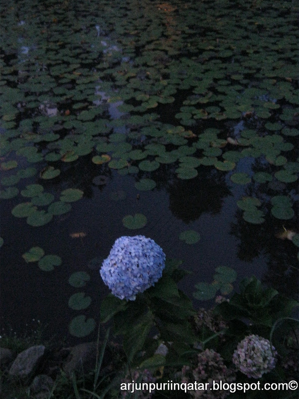
The Ward’s Lake was about 5 minutes drive from the Laitumkhrah Cathedral. The lake is surrounded by the lush green rolling campuses of the Shillong Raj Bhavan, the Shillong Club, Hotel Pinewood Ashok, the State Legislative assembly and the Shillong Botanical Garden.
Ward's Lake

It was getting dark when we reached the place and we hurried to see it. There was a small botanical garden next to the lake. The place is named after Sir William Ward, the then Chief Commissioner of Assam, who was cause behind the construction of this beautiful lake. The actual construction of the lake was carried out by Colonel Hopkinson in 1894 and the lake was for many years known as Hopkinson’s Tank. The locals however preferred it to call it Nan Polok or Polok’s Lake, after Polock, an executive engineer executed the civil works connected with the construction of the lake. According to a story, a Khasi prisoner, bored with the penitentiary routine requested the warden for some creative release by permitting him to create some construction over the Ward’s Lake. He was permitted to do so and what stands today is a marvelous site of the Wards Lake!

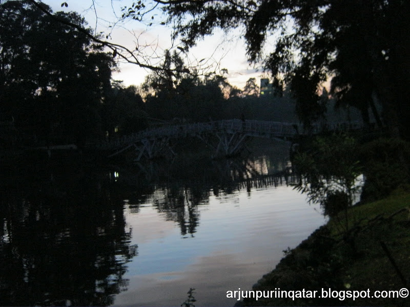
We went on the arched bridge over the lake which provided us an exhilarating view of the pictorial wealth of its clear, deep waters full of shoals of golden-yellow carp of varying hue and size. Sunset gave us some beautiful pictures. Boats of all sizes and shapes were moving from the lake boat-house, while people were buying Cola and other eatables available off its cafeteria’s laden shelves. We watched some couples enjoying the evening in paddling boats.


The horse shoe-shaped lake, with pleasant meandering boulevard paths around it, had several fishes and we came across a group of children feeding them from the bridge.

The lake has a most pleasant, winding walk-a-way all around its parameter set in cobbled sand stones, in the midst of picturesque, rolling flower-beds and fairyland lighting. It was amusing to watch young couples romancing in corners and seeing white ducks in the waters. Who said gardens are outdated dating spots? Those who say, I bet they have not been to the spectacular and the magnificent Ward’s Lake yet! Taking a stroll around the lake and seeing couples, no wonder we got the pinch in heart to fall in love again.


The sun had set and it was completely dark when the guards started whistling to warn visitors to vacate the place. We rushed to the gate not before clicking a few photos of armed men in uniform and guns standing in front of the lake’s gate.


Ganesh told us that the Golf Club would be closed as it was already late. The Shillong Golf Course, considered to be the first 18-hole Golf Course in India, is sometimes equated with Glen-Eagle Course in the United States because of its beauty and unique location. But unfortunately, we missed it :( Ganesh dropped us at the hotel and we thought of going for shopping.

Saturday, 22 October 2011

Lady Hydari Park in Shillong- Day 4

The park was nearby to the hotel in Barekh area, within five minutes we reached the spot and saw so many women selling popcorn and other eatables on the roadside. The park, named after the wife of Sir Akhbari Hydari, the first Indian Governor of Assam, was located between the expansive grounds of Pine Mount School on one side, the Shillong Rose Garden and the Shillong Civil Hospital campus on the other side. Roses and flowers of the most exquisite hue and colour welcomed us at the very entrance of the park.


The park was very big, having even a mini-zoo-cum-deer park. The park was landscaped in Japanese style. The park also had the pine native to the area – Pinus Khasiana. In the garden, every tree had four names: botanical name, common name, Khasi name and Garo name. Meghalaya has two official languages -- Khasi and Garo. Like most North-Eastern languages, Khasi and Garo don’t have script and rely on the English alphabets.


Deer park


We took a stroll in the park and saw the zoo before heading towards Laitumkhrah Cathedral.